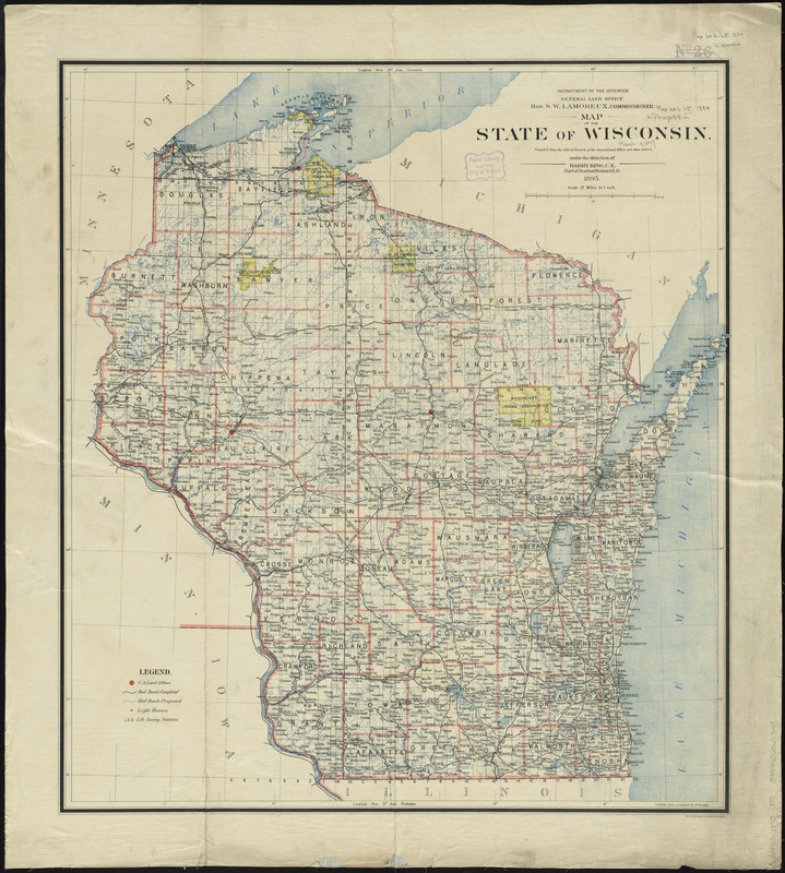
Map of the state of Wisconsin
Item Information
- Title:
- Map of the state of Wisconsin
- Creator:
- United States. General Land Office
- Name on Item:
-
compiled from the official records of the General Land Office and other sources under the direction of Harry King, C.E., chief of Drafting Division G.L.O. ; compiled, drawn and lettered by M. Hendges.
- Date:
-
1895
- Format:
-
Maps/Atlases
- Location:
-
Boston Public Library
Norman B. Leventhal Map & Education Center - Collection (local):
-
Norman B. Leventhal Map & Education Center Collection
- Subjects:
-
Wisconsin--Maps
Wisconsin--Administrative and political divisions--Maps
- Places:
-
Wisconsin
- Extent:
- 1 map : col. ; 72 x 65 cm.
- Terms of Use:
-
No known copyright restrictions.
No known restrictions on use.
- Publisher:
-
[Washington, D.C.] :
General Land Office
- Scale:
-
Scale [1:760,320]. 12 miles to 1 in.
- Language:
-
English
- Notes:
-
Relief shown by hachures.
Prime meridian: Greenwich and Washington.
"Department of the Interior General Land Office Hon. S.W. Lamoreux, Commissioner."
Shows counties, county seats, cities, Indian reservations, U.S. land offices, railroads, light houses, and life saving stations.
- Identifier:
-
06_01_008874
- Call #:
-
G4120 1895 .U55
- Barcode:
-
39999065657148