Toggle navigation
LMEC Home
Exhibitions
Georeferencing
Tools for Teachers
Collections
My Favorites
Sign Up / Log In
Search
Search the map portal
Map Collection
Map Collection
Map Sets
Search
Search
Search for
Search In
All Fields
Creator
Title
Subject
Place
Search All Digital Collections
Advanced Search
14021 Results
Filter your Search
Place
North and Central America
10,683
United States
8,692
Massachusetts
2,808
Suffolk (county)
1,682
Boston
1,638
Europe
1,420
Canada
1,009
New York
674
more
Place
»
Topic
Boston (Mass.)--Maps
748
City planning--Massachusetts--Boston--Maps
418
United States--History--Revolution, 1775-1783--Maps
331
United States--Maps
328
Real property--Massachusetts--Boston--Maps
254
Urban renewal--Massachusetts--Boston--Maps
254
North America--Maps--Early works to 1800
240
Massachusetts--Maps
234
more
Topic
»
Date
Date range begin
–
Date range end
Current results range from
1482
to
2023
View distribution
Creator
United States. Hydrographic Office
597
Boston Redevelopment Authority
404
Des Barres, Joseph F. W. (Joseph Frederick Wallet), 1722-1824
247
Jefferys, Thomas, -1771
172
Royal United Services Institute for Defence and Security Studies
160
George, III, King of Great Britain, 1738-1820
152
George, IV, King of Great Britain, 1762-1830
151
O.H. Bailey & Co
148
more
Creator
»
Format
Maps/Atlases
13,839
Manuscripts
985
Prints
102
Books
49
Drawings/Illustrations
44
Photographs
15
Objects/Artifacts
13
Documents
7
more
Format
»
Georeferenced
Yes
979
No
13,042
Collection
Norman B. Leventhal Map & Education Center Collection
9,110
American Revolutionary War-Era Maps
3,627
Boston and New England Maps
2,921
Urban Maps
2,480
Maritime Charts and Atlases
1,169
William L. Clements Library Collection
910
Library of Congress Collection
618
Boston Redevelopment Authority Collection
475
more
Collection
»
Available to use
No known restrictions
10,268
Creative Commons license
1,678
Search Constraints
Sort by relevance
relevance
title
date (asc)
date (desc)
Number of results to display per page
20 per page
10
per page
20
per page
50
per page
100
per page
View results as:
grid view
map view
Search Results
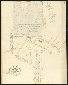
9861.
Plan of Plympton, surveyor's name not given, dated June 1, 1795.
9862.
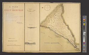
A plan of Point Ibberville
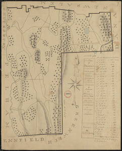
9863.
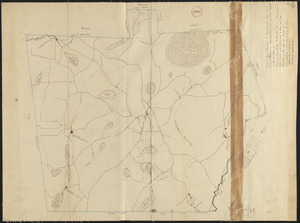
Plan of Poland (Bakerstown) surveyed by Osgood Carleton, dated 1792.
9864.
A plan of Port Royal harbour in Carolina with the proposed forts, depth of water &c
9865.
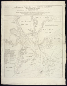
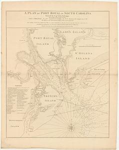
A plan of Port Royal in South Carolina
9866.
A plan of Port Royal in South Carolina
9867.
A plan of Port Royal in South Carolina
9868.
Plan of portion of park system from Common to Franklin Park : including Charles River Basin, Charlesbank, Commonwealth Avenue,...
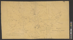
9869.
Plan of Portland
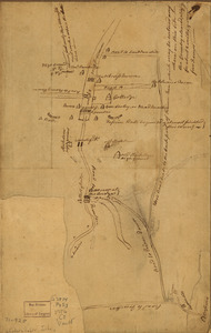
9870.
Plan of Portland made by Peleg Wadsworth, dated May 1795.
9871.
A plan of Portsmouth Harbour in the province of Virginia : shewing the works erected by the British forces for its defence, 1781
9872.
Plan of Portsmouth on Elizabeth River : from an exact survey made ye. 21st January 1781
9873.
Plan of Pownalborough (Wiscasset, etc.) surveyed by John T Foye, dated May, 1795.
9874.
Plan of Prescott made by E. S. Darling, dated October, 1830
9875.
Plan of Princess Ann and Norfolk counties
9876.
Plan of Princeton, Dec. 31, 1776
9877.
Plan of Princeton made by Amos Meriam, dated October 1830
9878.
Plan of Princeton, surveyor's name not given, dated May 6, 1795.
9879.
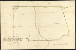
Plan of properties at Galloupe's Point : Swampscott, Mass.
9880.
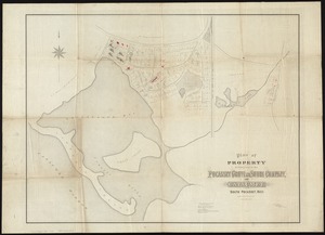
Plan of property belonging to the Pocasset Grove and Shore Company, at Cataumet, South Pocasset, Mass
‹ Prev
Next ›
1
2
…
490
491
492
493
494
495
496
497
498
…
701
702