Toggle navigation
LMEC Home
Exhibitions
Georeferencing
Tools for Teachers
Collections
My Favorites
Sign Up / Log In
Search
Search the map portal
Map Collection
Map Collection
Map Sets
Search
Search
Search for
Search In
All Fields
Creator
Title
Subject
Place
Search All Digital Collections
Advanced Search
13385 Results
Filter your Search
Place
North and Central America
9,353
United States
7,286
Suffolk (county)
1,664
Boston
1,621
Europe
1,035
Canada
949
Massachusetts
875
New York
534
more
Place
»
Topic
Boston (Mass.)--Maps
741
City planning--Massachusetts--Boston--Maps
418
United States--History--Revolution, 1775-1783--Maps
329
United States--Maps
315
Urban renewal--Massachusetts--Boston--Maps
254
Real property--Massachusetts--Boston--Maps
252
Massachusetts--Maps
219
Insurance surveys
197
more
Topic
»
Date
Date range begin
–
Date range end
Current results range from
1482
to
2023
View distribution
Creator
United States. Hydrographic Office
595
Boston Redevelopment Authority
403
Des Barres, Joseph F. W. (Joseph Frederick Wallet), 1722-1824
247
Royal United Services Institute for Defence and Security Studies
160
Jefferys, Thomas, -1771
154
George, III, King of Great Britain, 1738-1820
152
George, IV, King of Great Britain, 1762-1830
151
O.H. Bailey & Co
148
more
Creator
»
Format
Maps/Atlases
13,205
Manuscripts
985
Prints
102
Books
49
Drawings/Illustrations
44
Photographs
15
Objects/Artifacts
13
Documents
7
more
Format
»
Georeferenced
Yes
979
No
12,406
Collection
Norman B. Leventhal Map Center Collection
8,891
American Revolutionary War-Era Maps
3,305
Boston and New England Maps
2,804
Urban Maps
2,397
Maritime Charts and Atlases
1,150
William L. Clements Library Collection
910
Library of Congress Collection
618
Boston Redevelopment Authority Collection
475
more
Collection
»
Available to use
No known restrictions
9,952
Creative Commons license
1,677
Search Constraints
Sort by date (asc)
relevance
title
date (asc)
date (desc)
Number of results to display per page
20 per page
10
per page
20
per page
50
per page
100
per page
View results as:
grid view
map view
Search Results
9401.
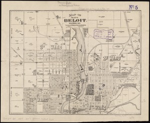
Map of the city of Beloit, Wisconsin, 1887
9402.
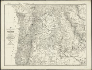
Map of the Department of the Columbia
9403.
Map of the rail roads of New Jersey 1887
9404.
Map of the railroads of the state of Massachusetts : accompanying the report of the railroad commissioners : 1887
9405.
Map of the State of Rhode Island and Providence Plantations
9406.
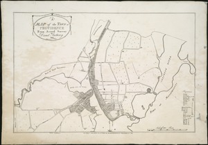
A map of the town of Providence from actual survey
9407.
Map of the United States
9408.
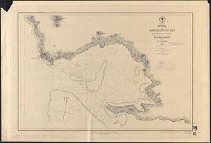
Massachusetts Bay with the coast from Cape Ann to Cape Cod
9409.
M'bua or Sandalwood Bay, Island of Vanua Levu, Feejee Group
9410.
Mediterranean, anchorages on the east coast of Spain : from Spanish government surveys of 1878
9411.
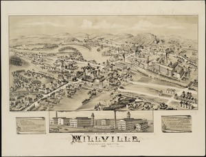
Millville, Massachusetts : 1887
9412.
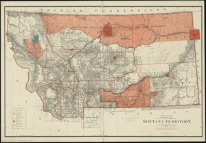
Montana Territory
9413.
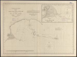
Mouth of the Teen-tsin-ho or Pei-ho and approach to the Sha-lui-tien banks
9414.
Needham, Massachusetts, 1887
9415.
New dissected map of the United States
9416.
North America, Bay of Fundy, Grand Manan Island and adjacent coast : from surveys by the British Admiralty in 1855, and by the...
9417.
North America, east coast, coast of Labrador from Cape St. Charles to Sandwich Bay : from British surveys to 1882
9418.
North America, east coast of Mexico, Tampico Harbor : from a survey in 1883 by the officers of the U.S.S. Alliance, Commander...
9419.
North America, west coast, anchorages in the Gulf of California : from a survey by Commander Geo. Dewey, U.S.N. and the...
9420.
North America, west coast, anchorages on the south coast of Lower California
‹ Prev
Next ›
1
2
…
467
468
469
470
471
472
473
474
475
…
669
670