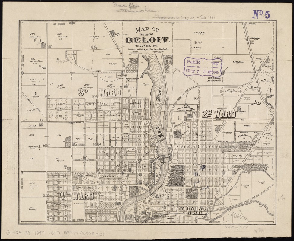
Map of the city of Beloit, Wisconsin, 1887
Item Information
- Title:
- Map of the city of Beloit, Wisconsin, 1887
- Panel title :
- Beautiful Beloit
- Creator:
- Bergendahl, Charles.
- Name on Item:
-
drawn by Charles Bergendahl.
- Date:
-
[ca. 1887]
- Format:
-
Maps/Atlases
- Location:
-
Boston Public Library
Norman B. Leventhal Map & Education Center - Collection (local):
-
Norman B. Leventhal Map & Education Center Collection
- Subjects:
-
Landowners--Wisconsin--Beloit--Maps
Beloit (Wis.)--Maps
- Places:
-
WisconsinRock (county)Beloit
- Extent:
- 1 map ; 31 x 38 cm., folded to 22 x 9 cm.
- Terms of Use:
-
No known copyright restrictions.
No known restrictions on use.
- Publisher:
-
[Beloit, Wis.] :
J.B. Dow
- Scale:
-
Scale [1:5,280]. [1 inch =] 440 ft.
- Language:
-
English
- Notes:
-
Shows wards, plat of town, roads, railroads, Rock River, city boundaries, and land ownership by name.
Text on verso.
- Identifier:
-
06_01_011328
- Call #:
-
G4124.B4 1887 .B47
- Barcode:
-
39999065683128


