Toggle navigation
LMEC Home
Exhibitions
Georeferencing
Tools for Teachers
Collections
My Favorites
Sign Up / Log In
Search
Search the map portal
Map Collection
Map Collection
Map Sets
Search
Search
Search for
Search In
All Fields
Creator
Title
Subject
Place
Search All Digital Collections
Advanced Search
14164 Results
Filter your Search
Place
North and Central America
10,811
United States
8,818
Massachusetts
2,820
Suffolk (county)
1,688
Boston
1,644
Europe
1,428
Canada
1,010
New York
683
more
Place
»
Topic
Boston (Mass.)--Maps
753
City planning--Massachusetts--Boston--Maps
419
United States--History--Revolution, 1775-1783--Maps
331
United States--Maps
331
Real property--Massachusetts--Boston--Maps
254
Urban renewal--Massachusetts--Boston--Maps
254
North America--Maps--Early works to 1800
241
Massachusetts--Maps
236
more
Topic
»
Date
Date range begin
–
Date range end
Current results range from
1482
to
2023
View distribution
Creator
United States. Hydrographic Office
597
Boston Redevelopment Authority
404
Des Barres, Joseph F. W. (Joseph Frederick Wallet), 1722-1824
247
Jefferys, Thomas, -1771
172
United States. National Ocean Service
170
Royal United Services Institute for Defence and Security Studies
160
George, III, King of Great Britain, 1738-1820
152
George, IV, King of Great Britain, 1762-1830
151
more
Creator
»
Format
Maps/Atlases
13,978
Manuscripts
985
Prints
102
Books
53
Drawings/Illustrations
44
Photographs
15
Objects/Artifacts
13
Documents
7
more
Format
»
Georeferenced
Yes
979
No
13,185
Collection
Norman B. Leventhal Map & Education Center Collection
9,162
American Revolutionary War-Era Maps
3,629
Boston and New England Maps
2,936
Urban Maps
2,511
Maritime Charts and Atlases
1,169
William L. Clements Library Collection
910
Library of Congress Collection
618
Boston Redevelopment Authority Collection
475
more
Collection
»
Available to use
No known restrictions
10,408
Creative Commons license
1,678
Search Constraints
Sort by relevance
relevance
title
date (asc)
date (desc)
Number of results to display per page
20 per page
10
per page
20
per page
50
per page
100
per page
View results as:
grid view
map view
Search Results
8481.
Part of modern Westmoreland County
8482.
Part of Monmouth County, New Jersey
8483.
Part of New England
8484.
Part of New Jersey
8485.
Part of New York City
8486.
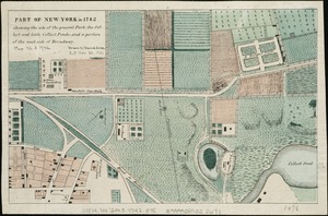
Part of New York in 1742 : showing the site of the present park, the collect and the little collect ponds, and a portion of the...
8487.
Part of North America : comprehending the course of Ohio, New England, New York, New Jersey, Pennsylvania, Maryland, Virginia,...
8488.
Part of Oxford and Cumberland counties, Me
8489.
The Part of Pennsylvania that lies between the forks of the Susquehannah, divided into townships
8490.
Part of the Anticosti Island; Mingan Island; Mignan Harbor
8491.
PART of the BAY of PLACENTIA
8492.
Part of the city of Honolulu, Oahu H.I.
8493.
Part of the city of New York, 27th Augt: 1778 [and] part of Long Island
8494.
Part of the counties of Charlotte and Albany, in the Province of New York : being the seat of war between the King's forces...
8495.
Part of the counties of Charlotte and Albany, in the province of New York; being the seat of war between the king's forces...
8496.
PART OF THE HARBOUR of ST IOHNS
8497.
[Part of the Island of Orleans and the Saint Lawrence River]
8498.
Part of the metropolitan district
8499.
Part of the modern counties of Bergen, Passaic, and Sussex, New Jersey
8500.
Part of the modern counties of Burlington and Camden, New Jersey
‹ Prev
Next ›
1
2
…
421
422
423
424
425
426
427
428
429
…
708
709


![Part of the city of New York, 27th Augt: 1778 [and] part of Long Island](https://bpldcassets.blob.core.windows.net/derivatives/metadata/commonwealth-oai:6d573t30q/image_thumbnail_300.jpg)

![[Part of the Island of Orleans and the Saint Lawrence River]](https://bpldcassets.blob.core.windows.net/derivatives/images/commonwealth:hx11z067t/image_thumbnail_300.jpg)