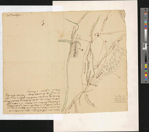
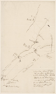
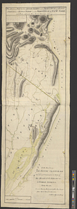
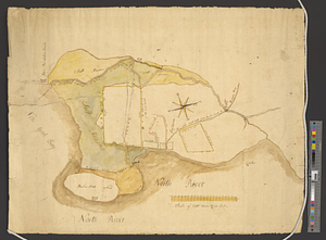
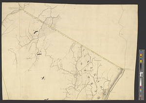
Part of the modern counties of Bergen, Passaic, and Sussex, New Jersey
This map is also available in American Revolutionary Geographies Online (ARGO), a collections portal especially built for material relating to the American Revolutionary War Era. Visit ARGO to learn more about this item and explore the historical geography of North America in the late eighteenth century.
Item Information
- Title:
- Part of the modern counties of Bergen, Passaic, and Sussex, New Jersey
- Date:
-
[1770–1779]
- Format:
-
Maps/Atlases
- Genre:
-
Manuscript maps
- Location:
- William L. Clements Library
- Collection (local):
-
William L. Clements Library Collection
- Subjects:
-
Bergen County (N.J.)--Maps
Passaic County (N.J.)--Maps
Sussex County (N.J.)--Maps
- Places:
-
New JerseyBergen (county)
New JerseyPassaic (county)
New JerseySussex (county)
- Extent:
- 1 ms. map : col. ; 45 x 59.5 cm.
- Terms of Use:
-
The University of Michigan Library provides access to these materials for educational and research purposes. These materials may be under copyright. If you decide to use any of these materials, you are responsible for making your own legal assessment and securing any necessary permission. If you have questions about the collection, please contact the William L. Clements Library.
Contact host institution for more information.
- Scale:
-
Scale ca. 1:126,720.
- Language:
-
English
- Catalog Record:
-
Catalog record
- Notes:
-
One section only of a finished, colored, topographical map.
Map includes boundary line between northern New Jersey and New York with comments on the settlement of this line by the boundary commissioners in 1769.
Clinton Maps 231.
- Notes (date):
-
This date is inferred.
- Identifier:
-
8315
- Barcode:
-
B2683555