Part of Oxford and Cumberland counties, Me
This map is also available in American Revolutionary Geographies Online (ARGO), a collections portal especially built for material relating to the American Revolutionary War Era. Visit ARGO to learn more about this item and explore the historical geography of North America in the late eighteenth century.
Item Information
- Title:
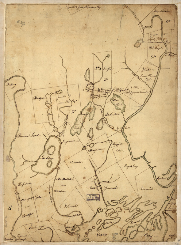
- Part of Oxford and Cumberland counties, Me
- Title (alt.):
-
Oxford and Cumberland counties, Me
- Creator:
- Greenleaf, S., Captain
- Name on Item:
-
Drawn by S. Greenleaf
- Date:
-
[1771?]
- Format:
-
Maps/Atlases
Manuscripts
- Location:
- Library of Congress Geography and Map Division
- Collection (local):
-
Library of Congress Collection
- Subjects:
-
Cumberland County (Me.)--Maps, Manuscript--Early works to 1800
Real property--Maine--Cumberland County--Maps--Early works to 1800
Land grants--Maine--Maps--Early works to 1800
- Places:
-
Cumberland (county)
- Extent:
- 1 manuscript map : hand color 49 x 35 cm.
- Terms of Use:
-
No known copyright restrictions.
This work is licensed for use under a Creative Commons Attribution Non-Commercial Share Alike License (CC BY-NC-SA).

- Scale:
-
Scale ca. 1:220,000
- Language:
-
English
- Catalog Record:
-
https://lccn.loc.gov/73691598
- Notes:
-
Title from verso.
Manuscript, pen-and-ink and watercolor.
Has watermark.
Land grants and No. 4 township dated 1771.
Shows townships, land grants, and landownership of Cumberland County and parts of Oxford, York, and Androscoggin counties.
- Notes (citation):
-
LC Maps of North America, 1750-1789, 835
- Identifier:
-
ar083500


