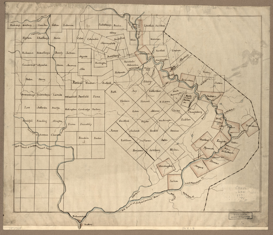
The Part of Pennsylvania that lies between the forks of the Susquehannah, divided into townships
This map is also available in American Revolutionary Geographies Online (ARGO), a collections portal especially built for material relating to the American Revolutionary War Era. Visit ARGO to learn more about this item and explore the historical geography of North America in the late eighteenth century.
Item Information
- Title:
- The Part of Pennsylvania that lies between the forks of the Susquehannah, divided into townships
- Title (alt.):
-
Pennsylvania that lies between the forks of the Susquehannah
- Creator:
- Susquehannah Company
- Date:
-
[1790?–1799?]
- Format:
-
Maps/Atlases
Manuscripts
- Location:
- Library of Congress Geography and Map Division
- Collection (local):
-
Library of Congress Collection
- Subjects:
-
Susquehanna Claim, 1753-1808--Maps, Manuscript--Early works to 1800
Wyoming Valley (Pa.)--Maps--Early works to 1800
- Places:
-
Luzerne (county)Wyoming Valley (area)
- Extent:
- 1 manuscript map : hand color on sheet 40 x 48 cm.
- Terms of Use:
-
No known copyright restrictions.
This work is licensed for use under a Creative Commons Attribution Non-Commercial Share Alike License (CC BY-NC-SA).

- Scale:
-
Scale ca. 1:345,000
- Language:
-
English
- Catalog Record:
-
https://lccn.loc.gov/gm71002328
- Notes:
-
Title from manuscript catalog of the Peter Force map collection.
Manuscript, pen-and-ink and watercolor.
Has watermark.
Covers old Westmoreland County of Connecticut, granted to the Susquehanna Company. The Connecticut settlers townships shown do not survive in name or boundaries.
- Notes (citation):
-
LC Maps of North America, 1750-1789, 1299
- Identifier:
-
ar129900


