Toggle navigation
LMEC Home
Exhibitions
Georeferencing
Tools for Teachers
Collections
My Favorites
Sign Up / Log In
Search
Search the map portal
Map Collection
Map Collection
Map Sets
Search
Search
Search for
Search In
All Fields
Creator
Title
Subject
Place
Search All Digital Collections
Advanced Search
13385 Results
Filter your Search
Place
North and Central America
9,353
United States
7,286
Suffolk (county)
1,664
Boston
1,621
Europe
1,035
Canada
949
Massachusetts
806
New York
534
more
Place
»
Topic
Boston (Mass.)--Maps
741
City planning--Massachusetts--Boston--Maps
418
United States--History--Revolution, 1775-1783--Maps
329
United States--Maps
315
Urban renewal--Massachusetts--Boston--Maps
254
Real property--Massachusetts--Boston--Maps
252
Massachusetts--Maps
219
Insurance surveys
197
more
Topic
»
Date
Date range begin
–
Date range end
Current results range from
1482
to
2023
View distribution
Creator
United States. Hydrographic Office
595
Boston Redevelopment Authority
403
Des Barres, Joseph F. W. (Joseph Frederick Wallet), 1722-1824
247
Royal United Services Institute for Defence and Security Studies
160
Jefferys, Thomas, -1771
154
George, III, King of Great Britain, 1738-1820
152
George, IV, King of Great Britain, 1762-1830
151
O.H. Bailey & Co
148
more
Creator
»
Format
Maps/Atlases
13,205
Manuscripts
985
Prints
102
Books
49
Drawings/Illustrations
44
Photographs
15
Objects/Artifacts
13
Documents
7
more
Format
»
Georeferenced
Yes
979
No
12,406
Collection
Norman B. Leventhal Map Center Collection
8,891
American Revolutionary War-Era Maps
3,305
Boston and New England Maps
2,804
Urban Maps
2,397
Maritime Charts and Atlases
1,150
William L. Clements Library Collection
910
Library of Congress Collection
618
Boston Redevelopment Authority Collection
475
more
Collection
»
Available to use
No known restrictions
9,952
Creative Commons license
1,677
Search Constraints
Sort by date (desc)
relevance
title
date (asc)
date (desc)
Number of results to display per page
20 per page
10
per page
20
per page
50
per page
100
per page
View results as:
grid view
map view
Search Results
8401.
Map of the northern, or, New England states of America, comprehending Vermont, New Hampshire, District of Main, Massachusetts,...
8402.
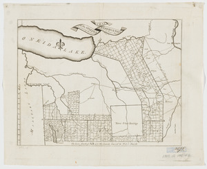
A map of the Oneida Reservation : including the lands leased to Peter Smith
8403.
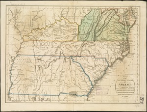
Map of the southern states of America, comprehending Maryland, Virginia, Kentucky, Territory s'th of the Ohio, North Carolina,...
8404.
A map of the state of Pennsylvania
8405.
A map of the State of Rhode Island
8406.
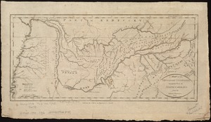
A map of the Tennassee Government formerly a part of North Carolina from the latest surveys
8407.
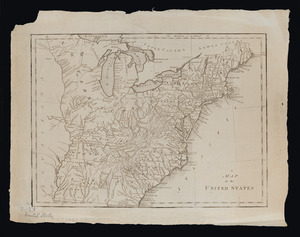
A map of the United States
8408.
A map of the United States
8409.
A map of the world from the best authorities
8410.
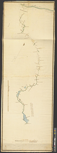
Middlesex Canal : copy'd from the survey of Mr. Thompson
8411.
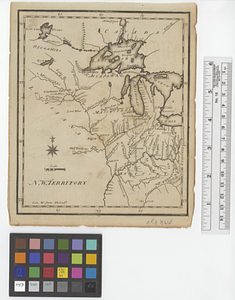
N. W. Territory
8412.
A new and improved chart of the West India or Carribbee [sic] Islands
8413.
A new map of the District of Maine : taken from the original map compiled by Osgood Carleton Esqr. : From the actual surveys...
8414.
A plan and section of the two routs in Woburn, say 1795 : Middlesex Canal
8415.
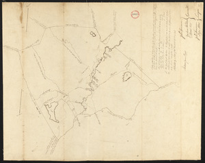
Plan of Abington, made by Daniel Shaw, dated 1795.
8416.
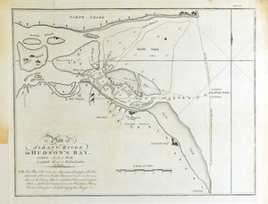
A plan of Albany River in Hudson's Bay : latitude 50⁰ 12' 0" North, longitude 82⁰ 40' 0" W. from London
8417.
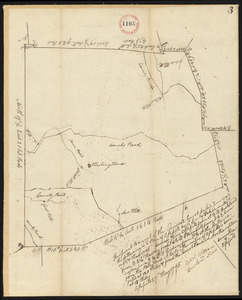
Plan of Alfred surveyed by Michel Bowden dated May 29, 1795.
8418.
Plan of Andover, surveyor's name not given, dated 1795.
8419.
Plan of Ashfield, surveyor's name not given, dated May 27, 1795.
8420.
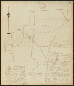
Plan of Athol, surveyor's name not given, dated April 27, 1795.
‹ Prev
Next ›
1
2
…
417
418
419
420
421
422
423
424
425
…
669
670


![A new and improved chart of the West India or Carribbee [sic] Islands](https://bpldcassets.blob.core.windows.net/derivatives/images/commonwealth:kk91fq95z/image_thumbnail_300.jpg)