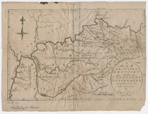
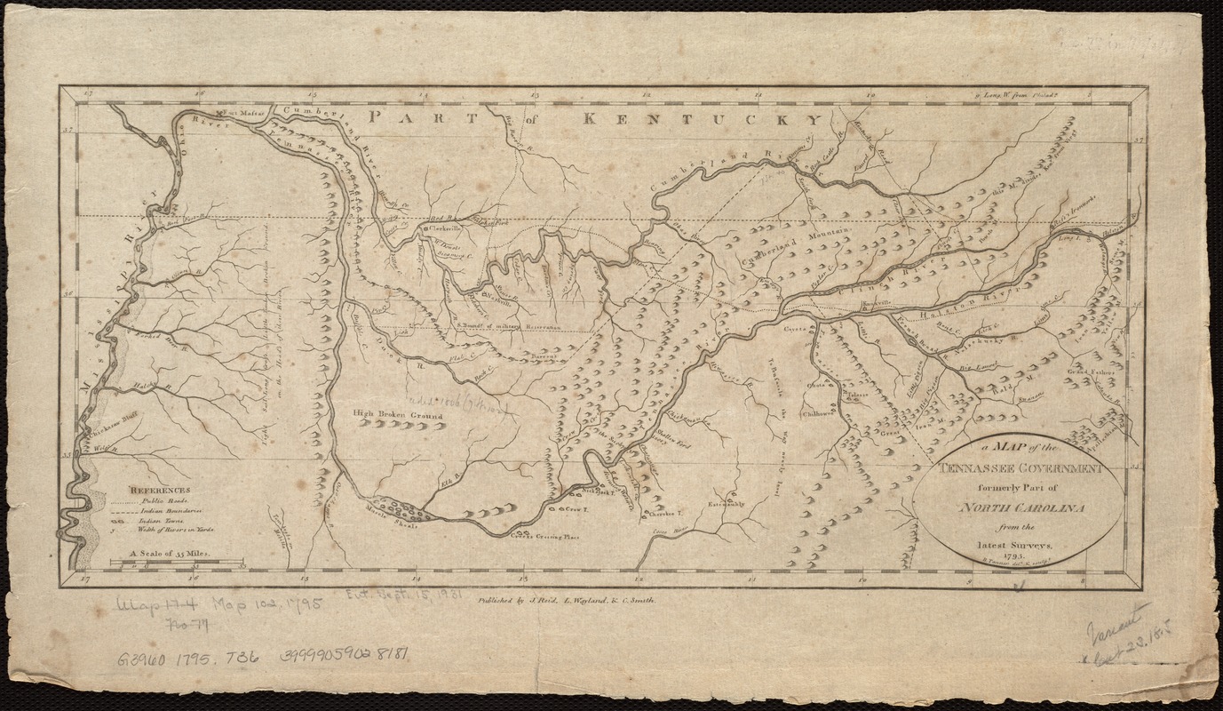
A map of the Tennassee Government formerly a part of North Carolina from the latest surveys
This map is also available in American Revolutionary Geographies Online (ARGO), a collections portal especially built for material relating to the American Revolutionary War Era. Visit ARGO to learn more about this item and explore the historical geography of North America in the late eighteenth century.
Item Information
- Title:
- A map of the Tennassee Government formerly a part of North Carolina from the latest surveys
- Creator:
- Tanner, Benjamin, 1775-1848
- Name on Item:
-
B. Tanner, delt. & sculpt.
- Date:
-
1795
- Format:
-
Maps/Atlases
- Location:
-
Boston Public Library
Norman B. Leventhal Map & Education Center - Collection (local):
-
Norman B. Leventhal Map & Education Center Collection
- Subjects:
-
Tennessee--Maps--Early works to 1800
- Places:
-
Tennessee
- Extent:
- 1 map ; 17 x 39 cm.
- Terms of Use:
-
No known copyright restrictions.
No known restrictions on use.
- Publisher:
-
[New York?] :
J. Reid, L. Wayland, & C. Smith
- Scale:
-
Scale [ca. 1:1,950,000].
- Language:
-
English
- Notes:
-
Relief shown pictorially.
Prime meridian: Philadelphia.
Appears in The American atlas. New York : J. Reid, 1796.
- Identifier:
-
06_01_006791
- Call #:
-
G3960 1795 .T36
- Barcode:
-
39999059028181