Toggle navigation
LMEC Home
Exhibitions
Georeferencing
Tools for Teachers
Collections
My Favorites
Sign Up / Log In
Search
Search the map portal
Map Collection
Map Collection
Map Sets
Search
Search
Search for
Search In
All Fields
Creator
Title
Subject
Place
Search All Digital Collections
Advanced Search
116 Results
My Search
Start Over
Date
1848
Remove constraint Date: <span class='single'>1848</span>
Filter your Search
Place
North and Central America
52
United States
42
Oceania
32
Massachusetts
18
Europe
12
French Polynesia
9
Boston
8
Fiji
8
more
Place
»
Topic
United States Exploring Expedition (1838-1842)
16
Tuamotu Archipelago (French Polynesia)--Maps
6
China--Maps
5
Boston (Mass.)--Maps
4
Korea--Maps
4
Massachusetts--Maps
3
Nautical charts--Fiji--Vanua Levu
3
New England--Maps
3
more
Topic
»
Date
1848
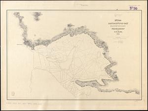
[remove]
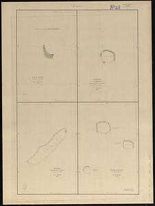
116
Date range begin
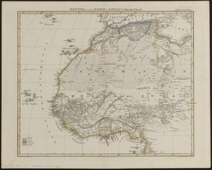
–
Date range end
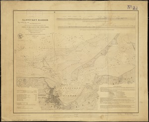
Current results range from
1770
to
1990
1848
to
1848
116
Creator
United States Exploring Expedition (1838-1842)
34
Wilkes, Charles, 1798-1877
31
Sherman & Smith
19
Boynton, George W., -1884
3
Knight, J. (Engraver)
3
Bouvé, Ephraim W., 1817-1897
2
Collinson, Richard, Sir, 1811-1883
2
Copley, Charles
2
more
Creator
»
Format
Maps/Atlases
115
Manuscripts
13
Books
1
Georeferenced
Yes
12
No
104
Collection
Norman B. Leventhal Map & Education Center Collection
98
Maritime Charts and Atlases
39
Boston and New England Maps
17
Urban Maps
14
American Revolutionary War-Era Maps
12
Library of Congress Collection
5
MacLean Collection Map Library
4
Newberry Library Collection
2
more
Collection
»
Available to use
No known restrictions
101
Creative Commons license
6
Search Constraints
Sort by relevance
relevance
title
date (asc)
date (desc)
Number of results to display per page
20 per page
10
per page
20
per page
50
per page
100
per page
View results as:
grid view
map view
Search Results
61.
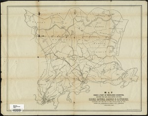
Map of parts of Essex & part of Middlesex counties, showing the rail road routes between Salem, Lowell, Boston & Lawrence
62.
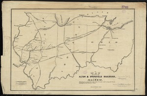
Map of the Alton & Springfield railroad, in Illinois : showing its connection with other roads and proposed roads leading to...
63.
Map of the British and French dominions in North America, drawn by order of the British government in 1755, showing what that...
64.
[Map of the end of Boston Wharf from which restrictions are to be taken off]
65.
Map of the Hudson River Rail Road from New York to Albany
66.
[Map of the railroads of Massachusetts running west from Boston]
67.
Map of the Southern provinces of the United States
68.
Map of the Troy & Greenfield Rail Road and its connections
69.
Map of the Vermont Central Rail Road and its connections, forming the Great Northern Route from the Atlantic to Montreal and...
70.
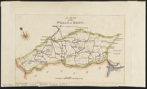
A map of the Weald of Kent
71.
[Map of W. Dall's lots in Athens County, Washington County, and Gallia County, Ohio]
72.
Massachusetts
73.
M'Bua or Sandalwood Bay, island of Vanua Levu, Feejee Group
74.
Metia Island, Paumotu Group ; Taweree or St. Simeon or Resolution Island, Paumotu Group ; Takurea or Wolconsky Island, Paumotu...
75.
Mills map of the several routes proposed to the Pacific Ocean from the head waters of the Missouri, to the Isthmus of Darien
76.
Mittel- und Nord-Africa, westl. theil
77.
Mount Auburn, avenues and paths
78.
Nantucket Harbor
79.
A new & complete map of the city of Boston, and precincts including part of Charlestown, Cambridge & Roxbury : from the best...
80.
North America : British provinces of New Brunswick, Nova Scotia, & part of Canada : compiled from recent surveys and adjusted...
‹ Prev
Next ›
1
2
3
4
5
6

![[Map of the end of Boston Wharf from which restrictions are to be taken off]](https://bpldcassets.blob.core.windows.net/derivatives/images/commonwealth:9s161d66k/image_thumbnail_300.jpg)
![[Map of the railroads of Massachusetts running west from Boston]](https://bpldcassets.blob.core.windows.net/derivatives/images/commonwealth:x059cc84w/image_thumbnail_300.jpg)


![[Map of W. Dall's lots in Athens County, Washington County, and Gallia County, Ohio]](https://bpldcassets.blob.core.windows.net/derivatives/images/commonwealth:w9505s00n/image_thumbnail_300.jpg)