Toggle navigation
LMEC Home
Exhibitions
Georeferencing
Tools for Teachers
Collections
My Favorites
Sign Up / Log In
Search
Search the map portal
Map Collection
Map Collection
Map Sets
Search
Search
Search for
Search In
All Fields
Creator
Title
Subject
Place
Search All Digital Collections
Advanced Search
13680 Results
My Search
Start Over
Date facet yearly ssim
1830
to
1834
Remove constraint Date facet yearly ssim: <span class='from'>1830</span> to <span class='to'>1834</span>
Filter your Search
Place
North and Central America
10,344
United States
8,475
Massachusetts
2,789
Suffolk (county)
1,677
Boston
1,633
Europe
1,415
Canada
950
New York
649
more
Place
»
Topic
Boston (Mass.)--Maps
747
City planning--Massachusetts--Boston--Maps
418
United States--History--Revolution, 1775-1783--Maps
329
United States--Maps
322
Real property--Massachusetts--Boston--Maps
254
Urban renewal--Massachusetts--Boston--Maps
254
Massachusetts--Maps
231
Insurance surveys
197
more
Topic
»
Date
Date range begin
–
Date range end
Current results range from
1482
to
2023
View distribution
Creator
United States. Hydrographic Office
597
Boston Redevelopment Authority
404
Des Barres, Joseph F. W. (Joseph Frederick Wallet), 1722-1824
247
Royal United Services Institute for Defence and Security Studies
160
Jefferys, Thomas, -1771
154
George, III, King of Great Britain, 1738-1820
152
George, IV, King of Great Britain, 1762-1830
151
O.H. Bailey & Co
148
more
Creator
»
Format
Maps/Atlases
13,499
Manuscripts
985
Prints
102
Books
49
Drawings/Illustrations
44
Photographs
15
Objects/Artifacts
13
Documents
7
more
Format
»
Georeferenced
Yes
979
No
12,701
Collection
Norman B. Leventhal Map & Education Center Collection
9,096
American Revolutionary War-Era Maps
3,305
Boston and New England Maps
2,915
Urban Maps
2,471
Maritime Charts and Atlases
1,169
William L. Clements Library Collection
910
Library of Congress Collection
618
Boston Redevelopment Authority Collection
475
more
Collection
»
Available to use
No known restrictions
10,246
Creative Commons license
1,678
Search Constraints
Sort by relevance
relevance
title
date (asc)
date (desc)
Number of results to display per page
20 per page
10
per page
20
per page
50
per page
100
per page
View results as:
grid view
map view
Search Results
7721.
Northern Philippines land utilization
7722.
Northern provinces of the United States
7723.
Northumbria, Cumberlandia, et Dunelmensis Episcopatus
7724.
Northwest Africa
7725.
Northwestern Georgia : (with portions of the adjoining states of Tennessee and Alabama) being part of the Department of the...
7726.
Northwestern part of Lake Huron
7727.
Norton, Massachusetts : 1891
7728.
Norumbega et Virginia
7729.
Norvegia regnum divisum in suos dioeceses Nidrosiensem, Bergensem, Opsloensem, et Stavangriensem et praefecturam Bahusiae quae...
7730.
Norway, from the best authorities
7731.
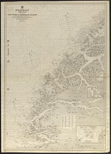
Norway, west coast : from Norwegian surveys, with corrections to 1886
7732.
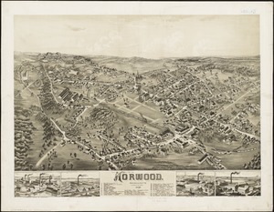
Norwood, Massachusetts : 1882
7733.
Notes sur les environs de York
7734.
Notes sur les environs de York: Plan donné par des arpenteurs du pays
7735.
[Notice for] View of Dedham
7736.
Noua Anglia, Nouum Belgium, et Virginia
7737.
Noua et accurata totius Americae tabula
7738.
Noua, et integra vniuersi orbis descriptio
7739.
Noua orbis terrarum delineatio singulari ratione accommodata meridiano tabb. Rudolphi astronomicarum
7740.
Noua totius terrarum orbis geographica ac hydrographica tabula
‹ Prev
Next ›
1
2
…
383
384
385
386
387
388
389
390
391
…
683
684


![[Notice for] View of Dedham](https://bpldcassets.blob.core.windows.net/derivatives/images/commonwealth:q524nh961/image_thumbnail_300.jpg)


