Toggle navigation
LMEC Home
Exhibitions
Georeferencing
Tools for Teachers
Collections
My Favorites
Sign Up / Log In
Search
Search the map portal
Map Collection
Map Collection
Map Sets
Search
Search
Search for
Search In
All Fields
Creator
Title
Subject
Place
Search All Digital Collections
Advanced Search
44 Results
My Search
Start Over
Date
1989
Remove constraint Date: <span class='single'>1989</span>
Filter your Search
Place
North and Central America
40
United States
39
Boston
29
Suffolk (county)
29
Massachusetts
28
New England
5
Roxbury
5
Fens
4
more
Place
»
Topic
City planning--Massachusetts--Boston--Maps
13
Boston (Mass.)--Maps
6
Fenway (Boston, Mass.)--Maps
4
Real property--Massachusetts--Boston--Maps
4
Roxbury (Boston, Mass.)--Maps
4
Buildings--Massachusetts--Boston--Maps
3
New England--Maps--Early works to 1800--Facsimiles
3
Back Bay (Boston, Mass.)--Maps
2
more
Topic
»
Date
1989
[remove]
44
Date range begin
–
Date range end
Current results range from
1770
to
1999
1989
to
1989
44
Creator
Boston Redevelopment Authority
14
DMC Engineering, Inc.
2
MassGIS (Office : Mass.)
2
Metropolitan/Columbia Plaza Venture
2
Stull and Lee
2
Ammann & Whitney (Firm)
1
Boston (Mass.). Department of Parks. Board of Commissioners
1
Boston Society of Architects
1
more
Creator
»
Format
Maps/Atlases
40
Drawings/Illustrations
3
Ephemera
2
Prints
1
Georeferenced
No
44
Collection
Norman B. Leventhal Map & Education Center Collection
37
Boston and New England Maps
32
Urban Maps
27
Boston Redevelopment Authority Collection
25
David Judkins Weaver Papers
7
American Revolutionary War-Era Maps
1
Sidney R. Knafel Map Collection at Phillips Academy
1
Available to use
No known restrictions
43
Search Constraints
Sort by relevance
relevance
title
date (asc)
date (desc)
Number of results to display per page
20 per page
10
per page
20
per page
50
per page
100
per page
View results as:
grid view
map view
Search Results
21.
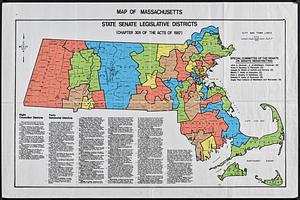
Map of Massachusetts : state Senate legislative districts : (Chapter 305 of the Acts of 1987)
22.
A map of New England and New York
23.
Map of the Back Bay Fens showing the public ways bordering and crossing them and the neighboring newly laid out parts of...
24.
A mapp of New England
25.
Mass pike air rights study
26.
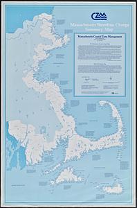
Massachusetts shoreline change summary map
27.
Outline map and view of the Prudential Center area
28.
Parcel 22
29.
Plan of corner of Centry & Beacon St's -- 1741
30.
Plan of Longwood Medical Area and Mission Hill
31.
Plan of the burnt district : showing proposed improvements in streets. Nov. 12th 1872
32.
Plans of structures next to the end towers of Longfellow Bridge
33.
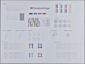
Printer test page
34.
Ruggles Center : existing condition plan
35.
Ruggles Center : site area diagram
36.
Sears Park conceptual site plan with historic waterway
37.
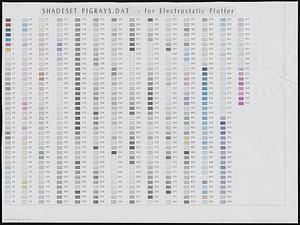
Shadesets
38.
A small map of the sea coast of New England together with the outlines of several of the provinces lying thereon, 1738
39.
The south part of New-England, as it is planted this yeare, 1635
40.
To his excellency William Shirley Esqr., Captain General and Commander in Chief, in and over his Majesty's province of the...
‹ Prev
Next ›
1
2
3