Toggle navigation
LMEC Home
Exhibitions
Georeferencing
Tools for Teachers
Collections
My Favorites
Sign Up / Log In
Search
Search the map portal
Map Collection
Map Collection
Map Sets
Search
Search
Search for
Search In
All Fields
Creator
Title
Subject
Place
Search All Digital Collections
Advanced Search
927 Results
My Search
Start Over
More Like
commonwealth-oai:s4659f980
Remove constraint More Like: commonwealth-oai:s4659f980
Filter your Search
Place
North and Central America
901
United States
641
Canada
206
New York
194
Quebec
111
Pennsylvania
61
New Jersey
54
Nova Scotia
48
more
Place
»
Topic
United States--History--Revolution, 1775-1783--Maps
305
United States--History--French and Indian War, 1754-1763--Maps
149
Saint Lawrence River--Maps
43
Newport (R.I.)--Maps
27
New York (State)--Maps
24
Hudson River (N.Y. and N.J.)--Maps
22
Québec (Québec)--Maps
21
Louisbourg (N.S.)--Maps
20
more
Topic
»
Date
Date range begin
–
Date range end
Current results range from
1700
to
1905
View distribution
Creator
Rocque, Mary Ann
29
Holland, Samuel, 1728-1801
25
Montrésor, John, 1736-1799
25
Bellin, Jacques Nicolas, 1703-1772
24
Jefferys, Thomas, -1771
24
Clinton, Henry, Sir, 1738?-1795
19
Robert Sayer and John Bennett (Firm)
15
Hills, John, active 1777-1819
13
more
Creator
»
Format
Maps/Atlases
911
Drawings/Illustrations
11
Documents
5
Prints
1
Georeferenced
Yes
1
No
926
Collection
American Revolutionary War-Era Maps
912
William L. Clements Library Collection
909
Norman B. Leventhal Map & Education Center Collection
15
MacLean Collection Map Library
2
New York Public Library Collection
1
Available to use
No known restrictions
15
Creative Commons license
1
Search Constraints
Sort by relevance
relevance
title
date (asc)
date (desc)
Number of results to display per page
20 per page
10
per page
20
per page
50
per page
100
per page
View results as:
grid view
map view
Search Results
741.
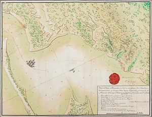
Plano del puerto de Floridablanca situado en la latd. N. de 54 [degrees] 16' longitud 28 [degrees] 15' al o de S. Blas...
742.
Plano del puerto de Gaston situado en la latitude N de 53 [degrees] 28' longd 24 [degrees] 21 al o de S. Blas descubierto este ano
743.
Plano del puerto de Panzacola en el qe. se manifiestan las marchas, campamentos y ataque de las tropas Espanolas : al mando del...
744.
Plat of lands at Paulus Hook, New Jersey
745.
A plot of Wm Young's land including Delaware paper mill
746.
Point Levi. Parish of St. Charles
747.
Portsmouth
748.
Portsmouth and Norfolk
749.
Position of the army near Iron Hill
750.
Position of the troops under Earl Cornwallis on the 28 and 29th September 1781; when the enemy first appeared
751.
Positions of the British troops between the Hudson River and the Bronx River at Valentine's Hill
752.
Post road & Kaskutahook
753.
Posts of the Hudson's Bay Company 1790
754.
The principal part of the province of New Jersey shewing the road and distances to the several towns between the North River...
755.
Progress of the British army from Elk River to Philadelphia, 1777
756.
Project for taking post at Crown Point, 13th May 1774 : 13th May 1774
757.
Proposed fortifications for Savannah
758.
Proposed redoubt at Canoe Place
759.
The proposed town of Dartmouth on the Mississippi River
760.
Providence and Newport
‹ Prev
Next ›
1
2
…
34
35
36
37
38
39
40
41
42
…
46
47
![Plano del puerto de Floridablanca situado en la latd. N. de 54 [degrees] 16' longitud 28 [degrees] 15' al o de S. Blas descuvierto este ano](https://bpldcassets.blob.core.windows.net/derivatives/metadata/commonwealth-oai:2227rn003/image_thumbnail_300.jpg)
![Plano del puerto de Gaston situado en la latitude N de 53 [degrees] 28' longd 24 [degrees] 21 al o de S. Blas descubierto este ano](https://bpldcassets.blob.core.windows.net/derivatives/metadata/commonwealth-oai:c534kn51x/image_thumbnail_300.jpg)