Toggle navigation
LMEC Home
Exhibitions
Georeferencing
Tools for Teachers
Collections
My Favorites
Sign Up / Log In
Search
Search the map portal
Map Collection
Map Collection
Map Sets
Search
Search
Search for
Search In
All Fields
Creator
Title
Subject
Place
Search All Digital Collections
Advanced Search
921 Results
My Search
Start Over
More Like
commonwealth-oai:ns068411s
Remove constraint More Like: commonwealth-oai:ns068411s
Filter your Search
Place
North and Central America
895
United States
634
Canada
205
New York
192
Quebec
111
Pennsylvania
60
New Jersey
54
Massachusetts
49
more
Place
»
Topic
United States--History--Revolution, 1775-1783--Maps
305
United States--History--French and Indian War, 1754-1763--Maps
149
Saint Lawrence River--Maps
43
Newport (R.I.)--Maps
27
New York (State)--Maps
24
Hudson River (N.Y. and N.J.)--Maps
21
Québec (Québec)--Maps
21
Louisbourg (N.S.)--Maps
20
more
Topic
»
Date
Date range begin
–
Date range end
Current results range from
1700
to
1990
View distribution
Creator
Rocque, Mary Ann
29
Holland, Samuel, 1728-1801
25
Montrésor, John, 1736-1799
25
Bellin, Jacques Nicolas, 1703-1772
24
Jefferys, Thomas, -1771
24
Clinton, Henry, Sir, 1738?-1795
19
Robert Sayer and John Bennett (Firm)
15
Hills, John, active 1777-1819
13
more
Creator
»
Format
Maps/Atlases
905
Drawings/Illustrations
11
Documents
5
Books
4
Prints
1
Georeferenced
No
921
Collection
American Revolutionary War-Era Maps
909
William L. Clements Library Collection
909
Norman B. Leventhal Map & Education Center Collection
8
Boston and New England Maps
7
Urban Maps
6
Massachusetts Real Estate Atlases
4
David Judkins Weaver Papers
1
Available to use
No known restrictions
8
Search Constraints
Sort by relevance
relevance
title
date (asc)
date (desc)
Number of results to display per page
20 per page
10
per page
20
per page
50
per page
100
per page
View results as:
grid view
map view
Search Results
741.
Portsmouth
742.
Portsmouth and Norfolk
743.
Position of the army near Iron Hill
744.
Position of the troops under Earl Cornwallis on the 28 and 29th September 1781; when the enemy first appeared
745.
Positions of the British troops between the Hudson River and the Bronx River at Valentine's Hill
746.
Post road & Kaskutahook
747.
Posts of the Hudson's Bay Company 1790
748.
The principal part of the province of New Jersey shewing the road and distances to the several towns between the North River...
749.
Progress of the British army from Elk River to Philadelphia, 1777
750.
Project for taking post at Crown Point, 13th May 1774 : 13th May 1774
751.
Proposed fortifications for Savannah
752.
Proposed redoubt at Canoe Place
753.
The proposed town of Dartmouth on the Mississippi River
754.
Providence and Newport
755.
The Rahway River valley, ca. 1780
756.
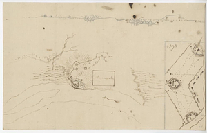
The rapids of the Ohio commonly called the falls 682 miles below Fort Pitt in 38 [degrees]; 08' no. latitude : by order of ye...
757.
Reconnoissance des ouvrages de Ouët Point : etablis pour couvrir et assurer la communication des états du nord avec ceux du...
758.
Region between Westchester Creek and the Bronx River
759.
Region of Gaspee Bay
760.
Region of Hare Island
‹ Prev
Next ›
1
2
…
34
35
36
37
38
39
40
41
42
…
46
47


![The rapids of the Ohio commonly called the falls 682 miles below Fort Pitt in 38 [degrees]; 08' no. latitude](https://bpldcassets.blob.core.windows.net/derivatives/metadata/commonwealth-oai:3x81bj69w/image_thumbnail_300.jpg)