Toggle navigation
LMEC Home
Exhibitions
Georeferencing
Tools for Teachers
Collections
My Favorites
Sign Up / Log In
Search
Search the map portal
Map Collection
Map Collection
Map Sets
Search
Search
Search for
Search In
All Fields
Creator
Title
Subject
Place
Search All Digital Collections
Advanced Search
990 Results
My Search
Start Over
More Like
commonwealth-oai:ht251g74x
Remove constraint More Like: commonwealth-oai:ht251g74x
Filter your Search
Place
North and Central America
964
United States
703
Canada
205
New York
199
Quebec
111
Pennsylvania
90
New Jersey
62
Virginia
50
more
Place
»
Topic
United States--History--Revolution, 1775-1783--Maps
305
United States--History--French and Indian War, 1754-1763--Maps
149
Pennsylvania--Maps
50
Saint Lawrence River--Maps
43
Maryland--Maps
37
New York (State)--Maps
32
Ohio--Maps
28
Newport (R.I.)--Maps
27
more
Topic
»
Date
Date range begin
–
Date range end
Current results range from
1700
to
1934
View distribution
Creator
Rocque, Mary Ann
29
Bellin, Jacques Nicolas, 1703-1772
26
Holland, Samuel, 1728-1801
25
Montrésor, John, 1736-1799
25
Jefferys, Thomas, -1771
24
Clinton, Henry, Sir, 1738?-1795
19
Robert Sayer and John Bennett (Firm)
15
Hills, John, active 1777-1819
13
more
Creator
»
Format
Maps/Atlases
974
Drawings/Illustrations
11
Documents
5
Manuscripts
1
Prints
1
Georeferenced
Yes
29
No
961
Collection
American Revolutionary War-Era Maps
924
William L. Clements Library Collection
909
Norman B. Leventhal Map & Education Center Collection
70
Maps from AAS
7
MacLean Collection Map Library
4
Urban Maps
2
Available to use
No known restrictions
70
Search Constraints
Sort by relevance
relevance
title
date (asc)
date (desc)
Number of results to display per page
20 per page
10
per page
20
per page
50
per page
100
per page
View results as:
grid view
map view
Search Results
881.
Sketch of part of the road from Freehold to Midde Town shewing the skirmish between the rear of the British army under the...
882.
Sketch of Presque Isle
883.
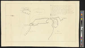
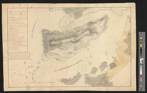
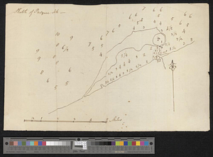
A sketch of St. Augustin [sic] Harbour &c.
884.
Sketch of St. Augustine and its environs
885.
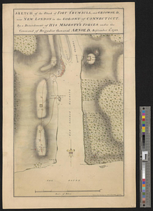
Sketch of the attack of Fort Trumbull, and Griswold, near New London in the colony of Connecticut, by a detachment of his...
886.
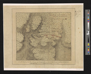
A sketch of the battle near Camden in South Carolina 16 Augst. 1780
887.
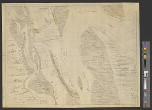
Sketch of the country from Fort Du Quesne to Niagara as described by an intelligent Indian who had resided there for a...
888.
Sketch of the country illustrating the late engagement in Long Island
889.
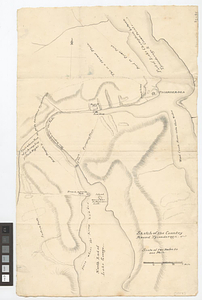
Sketch of the country round Tyconderoga
890.
A sketch of the disposition of the force at New York for the defence of the port
891.
A sketch of the east end of the peninsula where on is Hampton
892.
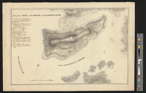
A sketch of the entrance from the sea to Apalachy and part of the environs
893.
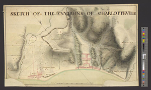
Sketch of the environs of Charlotteville
894.
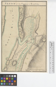
Sketch of the environs of King's bridge
895.
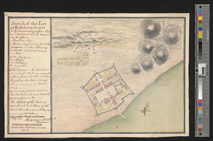
Sketch of the fort at Michilimackinac
896.
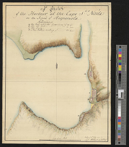
A sketch of the harbour at the Cape Slt: Nicola on the island of Hispaniola
897.
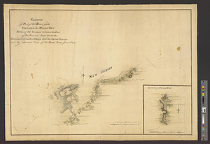
Sketch of the neck and harbour of Majabigwaduce
898.
Sketch of the neck and harbour of Majabigwaduce 20th Aug. 1779
899.
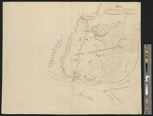
Sketch of the position of the army, 17th of June 1780
900.
Sketch of the position of the army on Long Island upon the morning of the 26th of August, 1776; with the march on the ensuing...
‹ Prev
Next ›
1
2
…
41
42
43
44
45
46
47
48
49
50
![A sketch of St. Augustin [sic] Harbour &c.](https://bpldcassets.blob.core.windows.net/derivatives/metadata/commonwealth-oai:vd670z134/image_thumbnail_300.jpg)