Toggle navigation
LMEC Home
Exhibitions
Georeferencing
Tools for Teachers
Collections
My Favorites
Sign Up / Log In
Search
Search the map portal
Map Collection
Map Collection
Map Sets
Search
Search
Search for
Search In
All Fields
Creator
Title
Subject
Place
Search All Digital Collections
Advanced Search
409 Results
My Search
Start Over
More Like
commonwealth:z603vr69k
Remove constraint More Like: commonwealth:z603vr69k
Filter your Search
Place
North and Central America
330
United States
233
Canada
99
North America
45
Suffolk (county)
35
Boston
33
New York
33
New England
17
more
Place
»
Topic
Canada--Maps--Early works to 1800
79
United States--History--Revolution, 1775-1783--Maps--Early works to 1800
38
United States--Maps--Early works to 1800
38
North America--Maps--Early works to 1800
31
Boston (Mass.)--History--Revolution, 1775-1783--Maps--Early works to 1800
18
New England--Maps--Early works to 1800
15
Northeastern States--Maps--Early works to 1800
11
Antilles, Greater--Maps--Early works to 1800
10
more
Topic
»
Date
Date range begin
–
Date range end
Current results range from
1576
to
1800
View distribution
Creator
Faden, William, 1749-1836
38
Jefferys, Thomas, -1771
33
Le Rouge, Georges-Louis
24
Des Barres, Joseph F. W. (Joseph Frederick Wallet), 1722-1824
21
Sayer, Robert, 1725-1794
19
Bellin, Jacques Nicolas, 1703-1772
16
Robert Sayer and John Bennett (Firm)
14
Korn, Christoph Heinrich, 1726-1783
11
more
Creator
»
Format
Maps/Atlases
366
Prints
32
Manuscripts
24
Drawings/Illustrations
9
Books
2
Georeferenced
Yes
13
No
396
Collection
American Revolutionary War-Era Maps
393
Richard H. Brown Revolutionary War Map Collection at Mount Vernon
293
Norman B. Leventhal Map & Education Center Collection
48
MacLean Collection Map Library
40
Boston and New England Maps
8
Library and Archives Canada Collection
8
Maritime Charts and Atlases
5
New York Public Library Collection
5
more
Collection
»
Available to use
Creative Commons license
305
No known restrictions
52
Search Constraints
Sort by relevance
relevance
title
date (asc)
date (desc)
Number of results to display per page
20 per page
10
per page
20
per page
50
per page
100
per page
View results as:
grid view
map view
Search Results
81.
Cours du fleuve St. Laurent : premiere feuille : contenant depuis le Lac Ontario jusqu'a Quebec
82.
Cours du fleuve St. Laurent : troisieme feuille : depuis le mont Camille jusqu'a l'isle d'Anticosti
83.
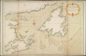
Golphe de Saint Laurent, contenant l'Isle de Terreneuve, Detroit de Belle-Isle, entrée du Fleuve St. Laurent, Isle Royale, et...
84.
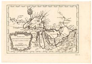
Karte von den seen in Canada zur allgemeinen historie der reisen
85.
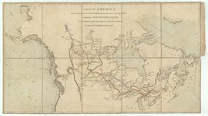
A map exhibiting all the new discoveries in the interior parts of North America inscribed by permission to the honorable...
86.
A map exhibiting all the new discoveries in the interior parts of North America inscribed by permission to the honorable...
87.
A map of America, between latitudes 40 and 70 north, and longitudes 45 and 180 west : exhibiting Mackenzie's track from...
88.
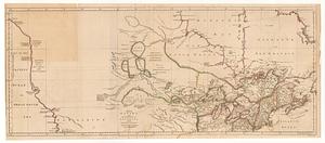
A map of Canada and the north part of Louisiana with the adjacent countrys
89.
A map of Canada and the north part of Louisiana with the adjacent countrys
90.
A map of part of Canada for the use of His Majesty's Secretary of State, compiled in the Surveyor Generals Office, pursuant to...
91.
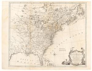
A map of the British and French dominions in North America : with the roads, distances, limits, and extent of the settlements,...
92.
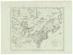
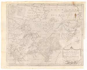
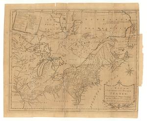
A map of the northern and middle states : comprehending the western territory and the British dominions in North America from...
93.
A map of the northern and middle states : comprehending the western territory and the British dominions in North America ;...
94.
A map of the northern and middle states : comprehending the western territory and the British dominions in North America, from...
95.
A map of the northern and middle states : comprehending the western territory and the British dominions in North America :...
96.
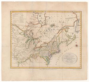
Map of the United States in North America : with the British, French and Spanish dominions adjoining, according to the treaty...
97.
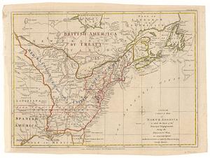
A new and accurate map of the British dominions in America, according to the treaty of 1763 : divided into the several...
98.
A new and correct map of North America in which the places of the principal engagements during the present war, are accurately...
99.
A New and correct map of the British colonies in North America comprehending eastern Canada with the province of Quebec, New...
100.
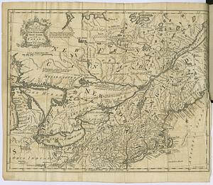
A new and correct map of the provinces of New England, New York, Canada or New France
‹ Prev
Next ›
1
2
3
4
5
6
7
8
9
…
20
21