Toggle navigation
LMEC Home
Exhibitions
Georeferencing
Tools for Teachers
Collections
My Favorites
Sign Up / Log In
Search
Search the map portal
Map Collection
Map Collection
Map Sets
Search
Search
Search for
Search In
All Fields
Creator
Title
Subject
Place
Search All Digital Collections
Advanced Search
136 Results
My Search
Start Over
More Like
commonwealth:z603vq60w
Remove constraint More Like: commonwealth:z603vq60w
Filter your Search
Place
North and Central America
92
United States
69
Pennsylvania
36
North America
35
New Jersey
34
New York
17
Philadelphia
10
Philadelphia (county)
10
more
Place
»
Topic
Pennsylvania--Maps--Early works to 1800
37
New Jersey--Maps--Early works to 1800
34
North America--Maps--Early works to 1800
27
United States--Maps--Early works to 1800
14
New York (State)--Maps--Early works to 1800
13
Northeastern States--Maps--Early works to 1800
10
Great Britain--Colonies--America--Maps--Early works to 1800
9
New Jersey--Administrative and political divisions--Maps--Early works to 1800
9
more
Topic
»
Date
Date range begin
–
Date range end
Current results range from
1672
to
1899
View distribution
Creator
Faden, William, 1749-1836
8
Jefferys, Thomas, -1771
8
Sayer, Robert, 1725-1794
8
Kitchin, Thomas, 1719-1784
7
Lodge, John, -1796
6
Bancker, Gerard, 1740-1799
5
Gibson, J. (John), active 1750-1792
5
Hinton, John, -1781
5
more
Creator
»
Format
Maps/Atlases
136
Manuscripts
3
Georeferenced
Yes
12
No
124
Collection
American Revolutionary War-Era Maps
131
New York Public Library Collection
86
Norman B. Leventhal Map & Education Center Collection
21
MacLean Collection Map Library
15
Richard H. Brown Revolutionary War Map Collection at Mount Vernon
8
British Library Collection
2
Maritime Charts and Atlases
2
Sidney R. Knafel Map Collection at Phillips Academy
2
more
Collection
»
Available to use
Creative Commons license
97
No known restrictions
21
Search Constraints
Sort by relevance
relevance
title
date (asc)
date (desc)
Number of results to display per page
20 per page
10
per page
20
per page
50
per page
100
per page
View results as:
grid view
map view
Search Results
1.
Seat of war in the environs of Philadeliphia
2.
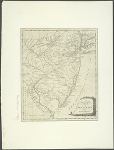
An exact map of New Jersey, Pensylvania [sic], New York, Maryland & Virginia, from the latest surveys
3.
La Pensilvania, la Nuova York, il Jersey Settentrio[na]le : con la parte occidentale del Connecticut, Massachusset-s-bay e...
4.
Carte de la Pensylvanie et du Nouveau Jersey
5.
New Engelland, New York, New Yersey und Pensilvania
6.
A new map of Virginia, Mary-land and the improved parts of Penn-sylvania & New Jersey
7.
Pensylvania Nova Jersey et Nova York cum Regionibus ad Fluvium Delaware in America sitis
8.
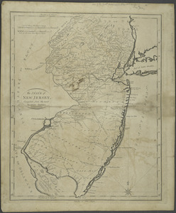
A New and accurate map of New Jersey : from the best authorities
9.
The Province of New Jersey : divided into East and West, commonly called the Jerseys
10.
The State of New Jersey : compiled from the most accurate surveys
11.
A New and accurate map of Virginia : and part of Maryland and Pennsylvania
12.
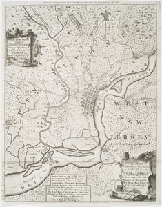
A map of that part of Pennsylvania now the principal seat of war in America : wherein may be seen the situation of...
13.
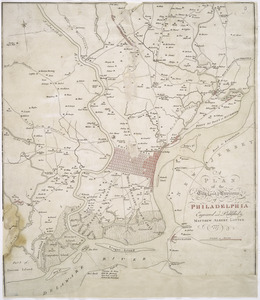
A plan of the city and environs of Philadelphia
14.
An accurate map of Staten Island : with that part of New York, Long Island and the Jerseys, which is the rendesvous of the two...
15.
Map no. I
16.
A map of the eastern part of the province of New York with part of New Jersey, & c
17.
A map of the eastern part of the province of New York with part of New Jersey, & c
18.
A map of the provinces of New-York and New Jersey, with a part of Pennsylvania and the Province of Quebec
19.
A mapp of New Jersey in America
20.
Mappa geographica Provinciæ Nova Eboraci ab Anglis New-York : dictæ ex ampliori delineatione ad exactas dimensiones concinnata...
‹ Prev
Next ›
1
2
3
4
5
6
7

![An exact map of New Jersey, Pensylvania [sic], New York, Maryland & Virginia, from the latest surveys](https://bpldcassets.blob.core.windows.net/derivatives/images/commonwealth:z603vp67m/image_thumbnail_300.jpg)
![La Pensilvania, la Nuova York, il Jersey Settentrio[na]le](https://bpldcassets.blob.core.windows.net/derivatives/images/commonwealth:z603vq53g/image_thumbnail_300.jpg)