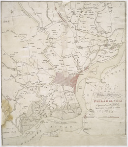
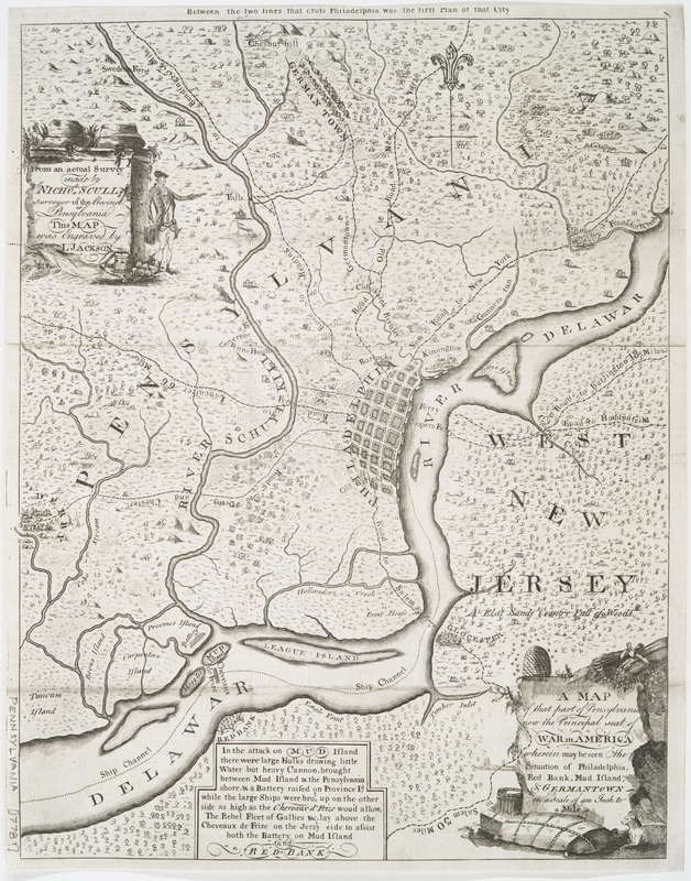
A map of that part of Pennsylvania now the principal seat of war in America : wherein may be seen the situation of Philadelphia, Red Bank, Mud Island, & Germantown
This map is also available in American Revolutionary Geographies Online (ARGO), a collections portal especially built for material relating to the American Revolutionary War Era. Visit ARGO to learn more about this item and explore the historical geography of North America in the late eighteenth century.
Item Information
- Title:
- A map of that part of Pennsylvania now the principal seat of war in America : wherein may be seen the situation of Philadelphia, Red Bank, Mud Island, & Germantown
- Creator:
- Scull, Nicholas, 1686?-1761?
- Contributor:
- Jackson, L.
- Name on Item:
-
from an actual survey made by Nichos. Scull, surveyor of the province of Pensylvania ; this map was engraved by L. Jackson.
- Date:
-
[1778?]
- Format:
-
Maps/Atlases
- Location:
- New York Public Library
- Collection (local):
-
Cartographic materials from the Emmet collection of manuscripts etc. relating to American history
- Subjects:
-
Philadelphia Region (Pa.)--Maps--Early works to 1800
Philadelphia (Pa.)--History--Revolution, 1775-1783--Maps--Early works to 1800
- Places:
-
Philadelphia (county)Philadelphia
- Extent:
- 1 map ; 38 x 30 cm.
- Terms of Use:
-
No known copyright restrictions.
This work is licensed for use under a Creative Commons Attribution Non-Commercial Share Alike License (CC BY-NC-SA).

- Publisher:
-
London? :
[s.n.]
- Scale:
-
Scale [1:63,360]
- Language:
-
English
- Catalog Record:
-
https://digitalcollections.nypl.org/items/510d47da-ee4b-a3d9-e040-e00a18064a99
- Notes:
-
Relief shown pictorially.
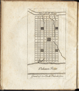
In upper margin: Between the two lines that cross Philadelphia was the first plan of that city.
Includes decorative cartouches and notes on attack on Fort Mifflin.