Toggle navigation
LMEC Home
Exhibitions
Georeferencing
Tools for Teachers
Collections
My Favorites
Sign Up / Log In
Search
Search the map portal
Map Collection
Map Collection
Map Sets
Search
Search
Search for
Search In
All Fields
Creator
Title
Subject
Place
Search All Digital Collections
Advanced Search
21 Results
My Search
Start Over
More Like
commonwealth:z603vn34v
Remove constraint More Like: commonwealth:z603vn34v
Filter your Search
Place
North and Central America
21
United States
17
New York
6
New Jersey
4
Chesapeake Bay
2
Delaware River
2
Louisiana
2
Mississippi
2
more
Place
»
Topic
Manuscript maps--Early works to 1800
8
New Jersey--History--Revolution, 1775-1783--Maps
7
New York (State)--History--Revolution, 1775-1783--Maps
3
Dumont de Montigny
2
Long Island, Battle of, New York, N.Y., 1776--Maps
2
Saratoga Campaign, 1777--Maps--Early works to 1800
2
Saratoga County (N.Y.)--Maps--Early works to 1800
2
United States--History--Revolution, 1775-1783--Maps
2
more
Topic
»
Date
Date range begin
–
Date range end
Current results range from
1747
to
1853
View distribution
Creator
Faden, William, 1749-1836
7
Dumont de Montigny
4
Hills, John, (Surveyor)
2
Lewis, Samuel, 1753 or 1754-1822
2
Faden, William, 1750?-1836
1
Hazlewood, J.
1
Hills, John, surveyor
1
Homann Erben (Firm)
1
more
Creator
»
Format
Maps/Atlases
21
Manuscripts
14
Georeferenced
Yes
1
No
20
Collection
American Revolutionary War-Era Maps
20
Newberry Library Collection
15
MacLean Collection Map Library
2
New York Public Library Collection
2
Norman B. Leventhal Map & Education Center Collection
1
Richard H. Brown Revolutionary War Map Collection at Mount Vernon
1
Available to use
Creative Commons license
3
No known restrictions
1
Search Constraints
Sort by relevance
relevance
title
date (asc)
date (desc)
Number of results to display per page
20 per page
10
per page
20
per page
50
per page
100
per page
View results as:
grid view
map view
Search Results
1.
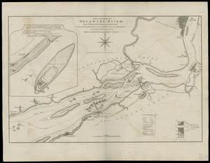
The course of Delaware River from Philadelphia to Chester, with the several forts and stackadoes raised by the rebels, and the...
2.
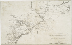
A map of the country from Rariton River in East Jersey to Elk Head in Maryland : shewing the several operations of the American...
3.
[Plan of engagement with British ships near Red Bank, New Jersey, October 22 and 23, 1777]
4.
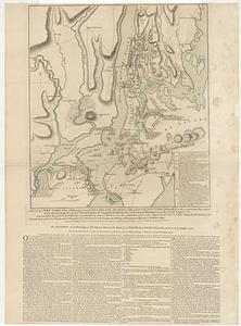
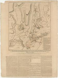
A plan of New York Island, with part of Long Island, Staten Island & east New Jersey, with a particular description of the...
5.
A plan of New York Island, with part of Long Island, Staten Island & east New Jersey, with a particular description of the...
6.
A plan of the northern part of New Jersey : shewing the positions of the American and British armies after crossing the North...
7.
Position der Koenigl;Grosbrittanischen und derer vereinigten provinzial armée in New York und dem Jerseys in Nord America im...
8.
Amerique Septentrionale : Acadie ou Nouvelle Ecosse aux anglois : Annapolis Royal
9.
The Attack and defeat of the American fleet under Benedict Arnold, by the Kings fleet commanded by Captn. Thos. Pringle, upon...
10.
Combat naval à la hauteur de la Baye de Chézapeake [sic] le 5 7bre. 1781
11.
Cours de l'Ohio depuis sa source jusqu'a sa jonction avec la Riviere d'Ouabache et les pais voisons
12.
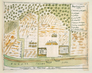
Habitation de l'autheur sur le fleuve
13.
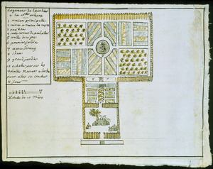
Logement de l'autheur a la Nlle. Orleans
14.
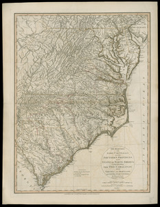
The marches of Lord Cornwallis in the Southern Provinces, now states of North America : comprehending the two Carolinas, with...
15.
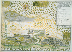
Plan du Fort des Yachoux, concession de Mgr. le duc de Belle Isle et associez, detruit 1729
16.
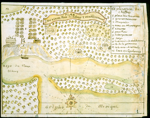
Plan du vieux Fort du Billoxi, 2 etablissement
17.
Plan of the peninsula of Chesopeak [sic] Bay
18.
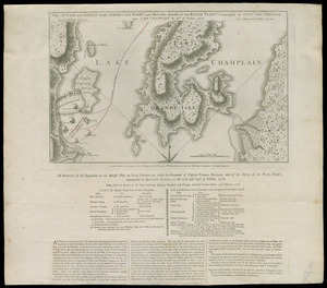
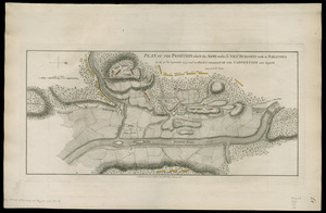
Plan of the position which the army under Lt. Genl. Burgoine took at Saratoga on the 10th of September, 1777, and in which it...
19.
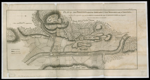
Plan of the position which the army under Lt. Genl. Burgoine took at Saratoga on the 10th of September, 1777, and in which it...
20.
Sketch of the position of the British forces at Elizabeth Town Point after their return from Connecticut Farm, in the province...
‹ Prev
Next ›
1
2
![[Plan of engagement with British ships near Red Bank, New Jersey, October 22 and 23, 1777]](https://bpldcassets.blob.core.windows.net/derivatives/images/commonwealth:9s161d76t/image_thumbnail_300.jpg)


![Combat naval à la hauteur de la Baye de Chézapeake [sic] le 5 7bre. 1781](https://bpldcassets.blob.core.windows.net/derivatives/images/commonwealth:z603vn12t/image_thumbnail_300.jpg)

![Plan of the peninsula of Chesopeak [sic] Bay](https://bpldcassets.blob.core.windows.net/derivatives/images/commonwealth:z603vn14c/image_thumbnail_300.jpg)
![Sketch of the position of the British forces at Elizabeth Town Point after their return from Connecticut Farm, in the province of East Jersey: under the command of his excelly. Leiutt. [sic] Genl. Knyphausen, on the 8th June 1780](https://bpldcassets.blob.core.windows.net/derivatives/images/commonwealth:z603vn418/image_thumbnail_300.jpg)