Toggle navigation
LMEC Home
Exhibitions
Georeferencing
Tools for Teachers
Collections
My Favorites
Sign Up / Log In
Search
Search the map portal
Map Collection
Map Collection
Map Sets
Search
Search
Search for
Search In
All Fields
Creator
Title
Subject
Place
Search All Digital Collections
Advanced Search
218 Results
My Search
Start Over
More Like
commonwealth:z603vg531
Remove constraint More Like: commonwealth:z603vg531
Filter your Search
Place
North and Central America
127
North America
79
United States
56
Canada
26
South America
20
West Indies
19
Boston
10
New York
10
more
Place
»
Topic
North America--Maps
80
United States--Maps
31
West Indies--Maps
20
South America--Maps
19
Canada--Maps
18
Boston (Mass.)--Maps
9
New England--Maps
9
New York (State)--Maps
9
more
Topic
»
Date
Date range begin
–
Date range end
Current results range from
1744
to
2005
View distribution
Creator
Reid, John, 1764?-1828
11
Anville, Jean Baptiste Bourguignon d', 1697-1782
9
Farwell, John Whittemore, 1843-1929
9
Bellin, Jacques Nicolas, 1703-1772
8
Kitchin, Thomas, 1718-1784
8
Gibson, J. (John), active 1750-1792
7
Carleton, Osgood, 1742-1816
6
Jefferys, Thomas, -1771
6
more
Creator
»
Format
Maps/Atlases
218
Manuscripts
13
Georeferenced
Yes
24
No
194
Collection
American Revolutionary War-Era Maps
160
American Antiquarian Society Collection
138
Norman B. Leventhal Map Center Collection
56
William L. Clements Library Collection
12
New York Public Library Collection
9
MacLean Collection Map Library
2
Boston and New England Maps
1
Maritime Charts and Atlases
1
more
Collection
»
Available to use
No known restrictions
56
Creative Commons license
11
Search Constraints
Sort by relevance
relevance
title
date (asc)
date (desc)
Number of results to display per page
50 per page
10
per page
20
per page
50
per page
100
per page
View results as:
grid view
map view
Search Results
1.
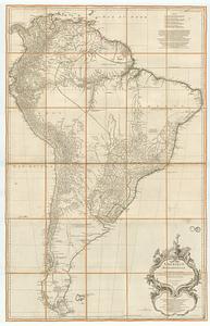
Map of the European settlements in South America and on the western coast of Africa
2.
Mapa de America sujecto à las observaciones astronomicas
3.
A New map of the whole continent of America, divided into North and South and West Indies. : Wherein are exactly described the...
4.
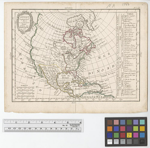
An accurate map of North America
5.
Amerique Septentrionale
6.
Carte de l'Amerique Septentrionale depuis le 28 degré de latitude jusqu'au 72
7.
A General map of North America
8.
A general map of North America
9.
A map of North America and the West Indies
10.
A Map of North America from the latest discoveries 1798
11.
Map of the European settlements in North America
12.
A New map of North America : with the West India Islands. : Divided according to the preliminary articles of Peace, signed at...
13.
North America
14.
North America. : Performed under the patronage of Louis Duke of Orleans, first prince of the blood
15.
North America, : as divided amongst the European powers
16.
Nth. America
17.
Amérique méridionale : publiée sous les auspices de Monseigneur le Duc d'Orleans prémier prince du Sang
18.
Amérique Méridionale
19.
Carte générale de L'Amérique Méridionale et des îles qui en dépendent
20.
Colombie et Guyanes
21.
The good neighbor pictorial map of South America
22.
A map of South America according to the best authorities
23.
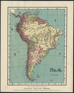
No. 4 : [South America]
24.
Peru, Chili and La Plata
25.
Rand, McNally & Co.'s indexed atlas of the world map of South America
26.
South America
27.
South America
28.
South America
29.
South America
30.
South America
31.
South America : reduced from the sheet map
32.
Südamerika
33.
America settle
34.
Amerikanisch-Spanischer kriegsschauplatz
35.
Amérique Septentrionale
36.
L'Amérique Septentrionale
37.
Amerique septentrionale divisée en ses principales parties
38.
Amérique Septentrionale divisée en ses principaux etats
39.
Amérique Septentrionale publiée sous les auspices de Monseigneur le Duc d'Orleans prémier prince du sang
40.
The British colonies in North America
41.
British possessions in North America
42.
Canada, Louisiane et terres angloises
43.
Canada, Louisiane et terres angloises
44.
Canada, Louisiane et terres angloises
45.
Carta universal en que se contiene todo lo que del mundo se ha descubierto fasta agora
46.
Carte de l'Amérique Septentrionale
47.
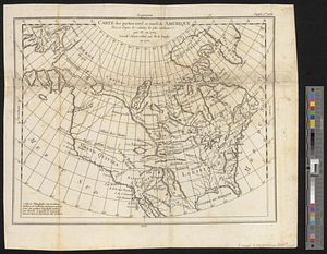
Carte des parties nord et ouest de l'Amérique dressée d'apres les relations les plus authentique par M... en 1764 : nouvelle...
48.
Carte du Mexique et des pays limitrophes situés au nord et à l'est : dressée d'après la grande carte de la Nouvelle Espagne...
49.
Colton's map of the United States of America, the British provinces, Mexico and the West Indies : showing the country from the...
50.
Diagram of the United States of America, Mexico, the West India Islands and Isthmus of Darien : showing proposed routes of the...
‹ Prev
Next ›
1
2
3
4
5