Toggle navigation
LMEC Home
Exhibitions
Georeferencing
Tools for Teachers
Collections
My Favorites
Sign Up / Log In
Search
Search the map portal
Map Collection
Map Collection
Map Sets
Search
Search
Search for
Search In
All Fields
Creator
Title
Subject
Place
Search All Digital Collections
Advanced Search
483 Results
My Search
Start Over
More Like
commonwealth:z603vg175
Remove constraint More Like: commonwealth:z603vg175
Filter your Search
Place
North and Central America
442
United States
388
Canada
36
Louisiana
35
North America
29
West Indies
24
Florida
23
New York
12
more
Place
»
Topic
United States--Maps
314
Elections--United States--Maps
36
Louisiana--Maps
35
Railroads--United States--Maps
34
North America--Maps
28
Canada--Maps
25
Florida--Maps
25
West Indies--Maps
25
more
Topic
»
Date
Date range begin
–
Date range end
Current results range from
1749
to
2020
View distribution
Creator
Paullin, Charles Oscar, 1868 or 1869-1944
70
Wright, John Kirtland, 1891-1969
70
Geological Survey (U.S.)
26
Reid, John, 1764?-1828
11
Carleton, Osgood, 1742-1816
9
Farwell, John Whittemore, 1843-1929
9
United States. Post Office Dept
9
Kitchin, Thomas, 1718-1784
8
more
Creator
»
Format
Maps/Atlases
481
Manuscripts
13
Prints
2
Books
1
Objects/Artifacts
1
Posters
1
Georeferenced
Yes
89
No
394
Collection
Norman B. Leventhal Map & Education Center Collection
321
American Revolutionary War-Era Maps
161
American Antiquarian Society Collection
138
William L. Clements Library Collection
20
MacLean Collection Map Library
3
David Judkins Weaver Papers
2
Mapping Boston Collection
2
Boston and New England Maps
1
more
Collection
»
Available to use
No known restrictions
246
Creative Commons license
6
Search Constraints
Sort by relevance
relevance
title
date (asc)
date (desc)
Number of results to display per page
20 per page
10
per page
20
per page
50
per page
100
per page
View results as:
grid view
map view
Search Results
201.
Map of the United States of North America, upper & lower Canada, New Brunswick, Nova Scotia & British Columbia, Mexico, Cuba,...
202.
Map of the United States, showing by colors the area of freedom and slavery, and the territories whose destiny is yet to be...
203.
Map of the United States showing principal cities, rivers, and mountain ranges
204.
Map of the United States, the British provinces, Mexico, &c : showing the routes of the U.S. Mail steam packets to California,...
205.
Map of United States showing drainage areas and index numbers
206.
Map showing distribution of indian stocks and tribes, between 1710-1720
207.
Map showing in five degrees of density the distribution of woodland within the territory of the United States, 1873
208.
Map showing Indian reservations within the limits of the United States
209.
Map showing Indian reservations within the limits of the United States, 1901
210.
Map showing Indian reservations within the limits of the United States, 1903
211.
Map showing Indian reservations within the limits of the United States, 1904
212.
Map showing Indian reservations within the limits of the United States, 1905
213.
Map showing Indian reservations within the limits of the United States, 1906
214.
Map showing lines of the Bell telephone companies in the United States and Canada : July 1st, 1904
215.
Maps showing the range, and, within the range, the degree of cultivation of certain principal crops
216.
Mean monthly average temperature
217.
Military map of the United States
218.
Military map of the United States of America showing location of all forces in training
219.
Missouri Compromise, March 20, 1820, Vote on striking out provisions restricting slavery
220.
Mitchell's national map of the American Republic or United States of North America : together with maps of the vicinities of...
‹ Prev
Next ›
1
2
…
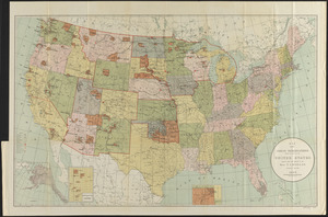
7
8
9
10
11
12
13
14
15
…
24
25