Toggle navigation
LMEC Home
Exhibitions
Georeferencing
Tools for Teachers
Collections
My Favorites
Sign Up / Log In
Search
Search the map portal
Map Collection
Map Collection
Map Sets
Search
Search
Search for
Search In
All Fields
Creator
Title
Subject
Place
Search All Digital Collections
Advanced Search
8643 Results
My Search
Start Over
More Like
commonwealth:x633f864h
Remove constraint More Like: commonwealth:x633f864h
Filter your Search
Place
North and Central America
5,880
United States
4,799
Massachusetts
2,056
Europe
1,359
Suffolk (county)
1,038
Boston
1,011
Canada
453
Asia
422
more
Place
»
Topic
Boston (Mass.)--Maps
580
United States--Maps
278
North America--Maps--Early works to 1800
180
Real property--Massachusetts--Boston--Maps
175
Massachusetts--Maps
160
Landowners--Massachusetts--Boston--Maps
133
New England--Maps
101
Europe--Maps
78
more
Topic
»
Date
Date range begin
–
Date range end
Current results range from
1482
to
2023
View distribution
Creator
United States. Hydrographic Office
594
O.H. Bailey & Co
148
Des Barres, Joseph F. W. (Joseph Frederick Wallet), 1722-1824
123
United States. Post Office Dept
120
Ptolemy, 2nd cent
100
Walling, Henry Francis, 1825-1888
94
Jefferys, Thomas, -1771
90
Geological Survey (U.S.)
86
more
Creator
»
Format
Maps/Atlases
8,584
Manuscripts
217
Prints
56
Books
36
Objects/Artifacts
10
Drawings/Illustrations
8
Posters
4
Georeferenced
Yes
872
No
7,771
Collection
Norman B. Leventhal Map & Education Center Collection
8,574
Boston and New England Maps
2,211
Urban Maps
1,940
Maritime Charts and Atlases
1,081
American Revolutionary War-Era Maps
678
Boston Redevelopment Authority Collection
87
New York Public Library Collection
32
Richard H. Brown Revolutionary War Map Collection at Mount Vernon
18
more
Collection
»
Available to use
No known restrictions
8,427
Creative Commons license
110
Search Constraints
Sort by relevance
relevance
title
date (asc)
date (desc)
Number of results to display per page
20 per page
10
per page
20
per page
50
per page
100
per page
View results as:
grid view
map view
Search Results
1441.
Central Virginia showing Lieut. Gen'l. U.S. Grant's Campaign and marches of the armies under his command in 1864-65
1442.
Central-America, southern shore of the Caribbean Sea, harbor of San Juan del Norte or Greytown
1443.
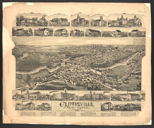
Centreville and Artic Centre, Rhode Island
1444.
Cereal map of Alberta : showing acreage under crop in each township in wheat, oats, barley and flax
1445.
Cestria comitatus Palatinus = the Countye Palatine of Chester
1446.
C.H. Guild & Co.'s newspaper map of New England
1447.
Change in median housing value, 2010 to 2018
1448.
Change in white population (non-Hispanic), 2010 to 2018
1449.
Changes in the bed of Boston Harbor from a comparison of the surveys of 1835-61
1450.
Channel on the north side of Vanua Levu from Aramula Passage to Muthuata Island, Feejee Islands
1451.
Channel on the north side of Vanua Levu from Aramula Passage to Muthuata Island, Feejee Islands
1452.
Chapinville, Mass : 1887
1453.
Chapman's new sectional map of Wisconsin
1454.
Chapmans' Quarries : Pennsylvania, 1885
1455.
Charles River
1456.
Charles River : carries shown by red lines
1457.
Charles River embankment : Boston district
1458.
Charles River embankment, section A
1459.
Charleston Harbor and its approaches showing the positions of the Rebel batteries
1460.
Charleston Harbor and its approaches showing the positions of the Rebel batteries
‹ Prev
Next ›
1
2
…
69
70
71
72
73
74
75
76
77
…
432
433