Toggle navigation
LMEC Home
Exhibitions
Georeferencing
Tools for Teachers
Collections
My Favorites
Sign Up / Log In
Search
Search the map portal
Map Collection
Map Collection
Map Sets
Search
Search
Search for
Search In
All Fields
Creator
Title
Subject
Place
Search All Digital Collections
Advanced Search
8647 Results
My Search
Start Over
More Like
commonwealth:x059cc95d
Remove constraint More Like: commonwealth:x059cc95d
Filter your Search
Place
North and Central America
5,886
United States
4,805
Massachusetts
2,068
Europe
1,392
Suffolk (county)
1,041
Boston
1,014
Canada
449
Asia
437
more
Place
»
Topic
Boston (Mass.)--Maps
582
United States--Maps
279
Real property--Massachusetts--Boston--Maps
175
Massachusetts--Maps
161
Landowners--Massachusetts--Boston--Maps
133
North America--Maps--Early works to 1800
103
New England--Maps
101
Europe--Maps
79
more
Topic
»
Date
Date range begin
–
Date range end
Current results range from
1482
to
2023
View distribution
Creator
United States. Hydrographic Office
595
O.H. Bailey & Co
148
Des Barres, Joseph F. W. (Joseph Frederick Wallet), 1722-1824
123
United States. Post Office Dept
120
Ptolemy, 2nd cent
100
Walling, Henry Francis, 1825-1888
94
Geological Survey (U.S.)
86
Jefferys, Thomas, -1771
85
more
Creator
»
Format
Maps/Atlases
8,587
Manuscripts
215
Prints
56
Books
36
Objects/Artifacts
10
Drawings/Illustrations
8
Posters
5
Georeferenced
Yes
868
No
7,779
Collection
Norman B. Leventhal Map & Education Center Collection
8,646
Boston and New England Maps
2,221
Urban Maps
1,992
Maritime Charts and Atlases
1,083
American Revolutionary War-Era Maps
616
Boston Redevelopment Authority Collection
87
William L. Clements Library Collection
1
Available to use
No known restrictions
8,504
Creative Commons license
47
Search Constraints
Sort by relevance
relevance
title
date (asc)
date (desc)
Number of results to display per page
20 per page
10
per page
20
per page
50
per page
100
per page
View results as:
grid view
map view
Search Results
1.
Colton's map of the state of Indiana : compiled from the United States surveys & other authentic sources ; exhibiting sections,...
2.
Manuscript maps of U.S. states
3.
Map of De Kalb Co., Indiana
4.
Map of Indiana
5.
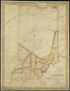
A map of part of the N:W: Territory of the United States : compiled from actual surveys, and the best information
6.
Map of the states of Ohio, Indiana and Illinois with the settled parts of Michigan & Wisconsin
7.
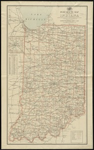
Post route map of the state of Indiana showing post offices with the intermediate distances on mail routes in operation on the...
8.
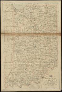
Post route map of the state of Indiana showing post offices with the intermediate distances on mail routes in operation on the...
9.
Post route map of the State of Ohio showing post offices with the intermediate distances and mail routes in operation on the...
10.
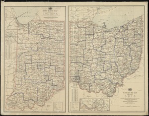
Post route map of the states of Ohio and Indiana with adjacent parts of Pennsylvania, Michigan, Illinois, Kentucky and West...
11.
State of Indiana
12.
State of Indiana
13.
State of Indiana coal fields and producing districts
14.
A plan of the river Ohio from Fort Pitt to the Mississipi : by order of ye chief engineer
15.
The 100th anniversary map of Abraham Lincoln's visit to Massachusetts, September 11-23, 1848
16.
1630 shoreline
17.
1879. Progress map of the U.S. Geographical Surveys west of the 100th Meridian : prepared under the direction of 1st Lieut....
18.
1903 Map of Salem and surrounding places
19.
19th annual convention of the National Association of Real Estate Boards : at Tulsa, June 7 to June 11 in 1926
20.
2005 significant U.S. hurricane strikes
‹ Prev
Next ›
1
2
3
4
5
…
432
433