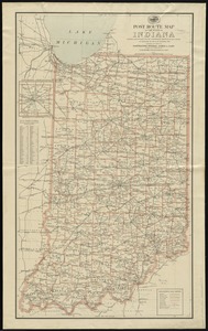
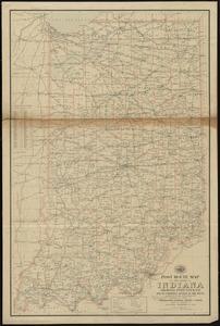
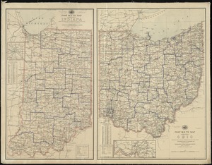
Colton's map of the state of Indiana : compiled from the United States surveys & other authentic sources ; exhibiting sections, fractional sections, railroads, canals, &c
Item Information
- Title:
- Colton's map of the state of Indiana : compiled from the United States surveys & other authentic sources ; exhibiting sections, fractional sections, railroads, canals, &c
- Title (alt.):
-
Map of the state of Indiana
- Creator:
- Colton, J. H. (Joseph Hutchins), 1800-1893
- Date:
-
1869
- Format:
-
Maps/Atlases
- Location:
-
Boston Public Library
Norman B. Leventhal Map & Education Center - Collection (local):
-
Norman B. Leventhal Map & Education Center Collection
- Subjects:
-
Railroads--Indiana--Maps
Indiana--Maps
- Places:
-
Indiana
- Extent:
- 1 map : col. ; 90 x 62 cm.
- Terms of Use:
-
No known copyright restrictions.
No known restrictions on use.
- Publisher:
-
New York :
G.W. and C.B. Colton & Co.
- Scale:
-
Scale [ca. 1:506,880]
- Language:
-
English
- Notes:
-
Prime meridian: Washington, D.C.
Includes population statistics tables.
- Identifier:
-
06_01_011155
- Call #:
-
G4090 1869 .C65
- Barcode:
-
39999065682989