Toggle navigation
LMEC Home
Exhibitions
Georeferencing
Tools for Teachers
Collections
My Favorites
Sign Up / Log In
Search
Search the map portal
Map Collection
Map Collection
Map Sets
Search
Search
Search for
Search In
All Fields
Creator
Title
Subject
Place
Search All Digital Collections
Advanced Search
8650 Results
My Search
Start Over
More Like
commonwealth:x059cc16r
Remove constraint More Like: commonwealth:x059cc16r
Filter your Search
Place
North and Central America
5,889
United States
4,806
Massachusetts
2,068
Europe
1,392
Suffolk (county)
1,042
Boston
1,015
Canada
449
Asia
437
more
Place
»
Topic
Boston (Mass.)--Maps
583
United States--Maps
279
Real property--Massachusetts--Boston--Maps
175
Massachusetts--Maps
161
Landowners--Massachusetts--Boston--Maps
133
North America--Maps--Early works to 1800
103
New England--Maps
101
Europe--Maps
79
more
Topic
»
Date
Date range begin
–
Date range end
Current results range from
1482
to
2023
View distribution
Creator
United States. Hydrographic Office
595
O.H. Bailey & Co
148
Des Barres, Joseph F. W. (Joseph Frederick Wallet), 1722-1824
123
United States. Post Office Dept
120
Ptolemy, 2nd cent
100
Walling, Henry Francis, 1825-1888
94
Geological Survey (U.S.)
86
Jefferys, Thomas, -1771
85
more
Creator
»
Format
Maps/Atlases
8,590
Manuscripts
215
Prints
56
Books
36
Objects/Artifacts
10
Drawings/Illustrations
8
Posters
5
Georeferenced
Yes
868
No
7,782
Collection
Norman B. Leventhal Map & Education Center Collection
8,646
Boston and New England Maps
2,221
Urban Maps
1,991
Maritime Charts and Atlases
1,083
American Revolutionary War-Era Maps
619
Boston Redevelopment Authority Collection
87
William L. Clements Library Collection
3
American Antiquarian Society Collection
1
Available to use
No known restrictions
8,504
Creative Commons license
47
Search Constraints
Sort by relevance
relevance
title
date (asc)
date (desc)
Number of results to display per page
20 per page
10
per page
20
per page
50
per page
100
per page
View results as:
grid view
map view
Search Results
1.
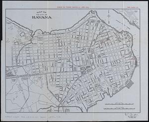
Map of Havana and Havana Harbor showing the fortifications and public buildings
2.
Map of the city of Havana : [casos de fiebre amarilla, muertes de niños menores, y muertes de tuberculosis]
3.
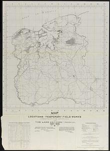
Map showing locations of temporary field works erected by the Spanish for the land defense of Havana, 1897-1898
4.
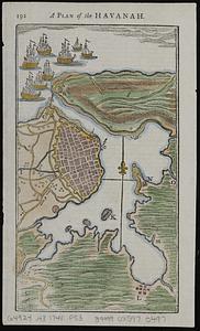
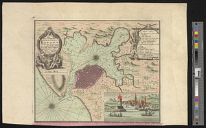
A plan of the Havanah
5.
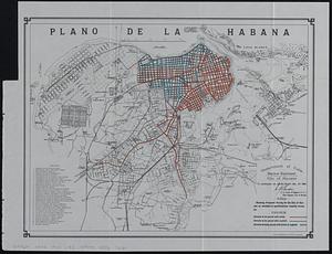
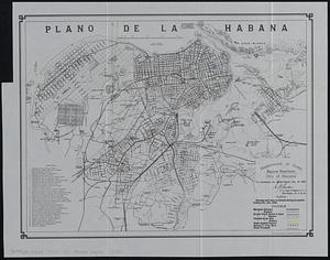
Plano de la Habana : showing proposed paving for the city of Havana as encluded in specifications recently drawn up
6.
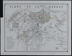
Plano de la Habana : showing work done on streets during six months ending Dec. 31st, 1900
7.
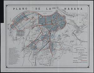
Plano de la Habana : showing track laying completed and paved
8.
Plano de la Habana : showing status of survey for street grades
9.
The Rand-McNally map of the city of Havana showing suburbs, parks, forts, and principal buildings
10.
West Indies, Cuba, harbor of Havana : from the most recent Spanish surveys to 1887
11.
West Indies, Cuba, harbor of Havana : from the most recent Spanish surveys to 1879
12.
Neu und verbesseter plan der st. u. hafens Havanah auf der ins. Cvba mit den wasser tiefen, sand, baencken und klippen...
13.
Plan of the city & harbour of Havanna, capital of Cuba
14.
Plan of the Havana with part of the country adjacent
15.
Various plans and draughts of cities, towns, harbours &c. drawn from the latest authorities
16.
The 100th anniversary map of Abraham Lincoln's visit to Massachusetts, September 11-23, 1848
17.
1630 shoreline
18.
1879. Progress map of the U.S. Geographical Surveys west of the 100th Meridian : prepared under the direction of 1st Lieut....
19.
1903 Map of Salem and surrounding places
20.
19th annual convention of the National Association of Real Estate Boards : at Tulsa, June 7 to June 11 in 1926
‹ Prev
Next ›
1
2
3
4
5
…
432
433