Toggle navigation
LMEC Home
Exhibitions
Georeferencing
Tools for Teachers
Collections
My Favorites
Sign Up / Log In
Search
Search the map portal
Map Collection
Map Collection
Map Sets
Search
Search
Search for
Search In
All Fields
Creator
Title
Subject
Place
Search All Digital Collections
Advanced Search
8945 Results
My Search
Start Over
More Like
commonwealth:wd3768095
Remove constraint More Like: commonwealth:wd3768095
Filter your Search
Place
North and Central America
6,176
United States
5,080
Massachusetts
2,216
Europe
1,396
Suffolk (county)
1,210
Boston
1,183
Canada
450
Asia
438
more
Place
»
Topic
Boston (Mass.)--Maps
752
United States--Maps
282
Massachusetts--Maps
235
Real property--Massachusetts--Boston--Maps
195
City planning--Massachusetts--Boston--Maps
158
Landowners--Massachusetts--Boston--Maps
142
New England--Maps
106
North America--Maps--Early works to 1800
103
more
Topic
»
Date
Date range begin
–
Date range end
Current results range from
1482
to
2023
View distribution
Creator
United States. Hydrographic Office
595
Boston Redevelopment Authority
162
O.H. Bailey & Co
148
Des Barres, Joseph F. W. (Joseph Frederick Wallet), 1722-1824
124
United States. Post Office Dept
120
Ptolemy, 2nd cent
100
Walling, Henry Francis, 1825-1888
95
Geological Survey (U.S.)
92
more
Creator
»
Format
Maps/Atlases
8,884
Manuscripts
217
Prints
56
Books
36
Objects/Artifacts
10
Drawings/Illustrations
8
Posters
6
Ephemera
1
Georeferenced
Yes
894
No
8,051
Collection
Norman B. Leventhal Map & Education Center Collection
8,772
Boston and New England Maps
2,411
Urban Maps
2,143
Maritime Charts and Atlases
1,087
American Revolutionary War-Era Maps
662
Boston Redevelopment Authority Collection
195
Mapping Boston Collection
29
William L. Clements Library Collection
23
more
Collection
»
Available to use
No known restrictions
8,708
Creative Commons license
80
Search Constraints
Sort by relevance
relevance
title
date (asc)
date (desc)
Number of results to display per page
20 per page
10
per page
20
per page
50
per page
100
per page
View results as:
grid view
map view
Search Results
7461.
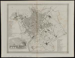
Rome
7462.
Ropewalk bldg. Charlestown Navy Yard
7463.
Rose garden in Fens-Back Bay
7464.
Roumania
7465.
Route and pictorial map of Maine
7466.
Route chart showing routes to and from northwestern Europe
7467.
Route map, Juneau to Porcupine River, Alaska
7468.
Route of the Albany & West Stockbridge Rail Road
7469.
Route of the late expedition commanded by Act'g Rear Admiral D.D. Porter U.S.N. attempting to get into the Yazoo River by the...
7470.
Route of the Massachusetts nautical training ship Ranger, 1909
7471.
Routes of Grand Trunk Pacific Steamships : Pacific coast service
7472.
Le Royaume d'Angleterre : divisé selon les sept Royaumes, ou Heptarchie des Saxons, avec la Principauté de Galles, et...
7473.
Royaume de Danemarck : qui comprend le Nort-Jutland divisé en ses quatre dioceses, le Sud-Jutland divisé en ses deux duchés...
7474.
Le Royaume de Hongrie, divisé en Haute et Basse Hongrie, Transilvanie, Esclavonie et Croatie
7475.
Royaume d'Irlande : divisé en ses quatre provinces et subdivisé en comtés
7476.
Ruatan or Rattan
7477.
Rugby : belonging to Wood, Harmon & Co
7478.
Rumänien und Bulgarien
7479.
Rural cultural regions in the United States
7480.
Russell
‹ Prev
Next ›
1
2
…
370
371
372
373
374
375
376
377
378
…
447
448