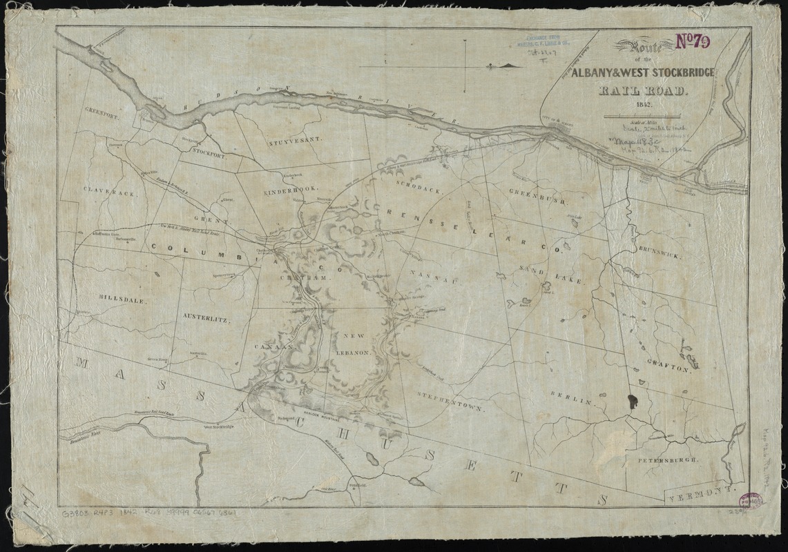
Route of the Albany & West Stockbridge Rail Road
Item Information
- Title:
- Route of the Albany & West Stockbridge Rail Road
- Date:
-
1842
- Format:
-
Maps/Atlases
- Location:
-
Boston Public Library
Norman B. Leventhal Map & Education Center - Collection (local):
-
Norman B. Leventhal Map & Education Center Collection
- Subjects:
-
Albany and West Stockbridge Rail-Road Company--Maps
Railroads--New York (State)--Columbia County--Maps
Railroads--New York (State)--Rensselaer County--Maps
Rensselaer County (N.Y.)--Maps
Columbia County (N.Y.)--Maps
- Places:
-
New YorkRensselaer (county)
New YorkColumbia (county)
- Extent:
- 1 map ; 43 x 60 cm.
- Terms of Use:
-
No known copyright restrictions.
No known restrictions on use.
- Publisher:
-
Albany, N.Y.? :
[s.n.]
- Scale:
-
Scale [ca. 1:120,000]
- Language:
-
English
- Notes:
-
Relief shown by hachures.
Covers the area between the Hudson River and the western border of Massachusetts in the vicinity of Albany, N.Y. and West Stockbridge, Mass.
Oriented with north to the right.
- Identifier:
-
06_01_010720
- Call #:
-
G3803.R4P3 1842 .R68
- Barcode:
-
39999065676361