Toggle navigation
LMEC Home
Exhibitions
Georeferencing
Tools for Teachers
Collections
My Favorites
Sign Up / Log In
Search
Search the map portal
Map Collection
Map Collection
Map Sets
Search
Search
Search for
Search In
All Fields
Creator
Title
Subject
Place
Search All Digital Collections
Advanced Search
8750 Results
My Search
Start Over
More Like
commonwealth:w9505s824
Remove constraint More Like: commonwealth:w9505s824
Filter your Search
Place
North and Central America
5,975
United States
4,871
Massachusetts
2,079
Europe
1,396
Suffolk (county)
1,046
Boston
1,019
Canada
498
Asia
438
more
Place
»
Topic
Boston (Mass.)--Maps
586
United States--Maps
282
Real property--Massachusetts--Boston--Maps
175
Massachusetts--Maps
162
Landowners--Massachusetts--Boston--Maps
133
North America--Maps--Early works to 1800
106
New England--Maps
102
Canada--Maps--Early works to 1800
79
more
Topic
»
Date
Date range begin
–
Date range end
Current results range from
1482
to
2023
View distribution
Creator
United States. Hydrographic Office
595
O.H. Bailey & Co
148
Des Barres, Joseph F. W. (Joseph Frederick Wallet), 1722-1824
123
United States. Post Office Dept
120
Ptolemy, 2nd cent
100
Walling, Henry Francis, 1825-1888
94
Jefferys, Thomas, -1771
87
Geological Survey (U.S.)
86
more
Creator
»
Format
Maps/Atlases
8,690
Manuscripts
217
Prints
56
Books
36
Objects/Artifacts
10
Drawings/Illustrations
8
Posters
5
Georeferenced
Yes
869
No
7,881
Collection
Norman B. Leventhal Map & Education Center Collection
8,694
Boston and New England Maps
2,233
Urban Maps
2,023
Maritime Charts and Atlases
1,083
American Revolutionary War-Era Maps
670
Boston Redevelopment Authority Collection
87
MacLean Collection Map Library
38
Library and Archives Canada Collection
8
more
Collection
»
Available to use
No known restrictions
8,553
Creative Commons license
54
Search Constraints
Sort by relevance
relevance
title
date (asc)
date (desc)
Number of results to display per page
20 per page
10
per page
20
per page
50
per page
100
per page
View results as:
grid view
map view
Search Results
41.
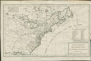
Carte générale des Etats-Unis de l'Amerique Septentrionale, renfermant aussi quelques provinces angloises adjacentes, pour les...
42.
Carte generale du Canada ou Nouvelle France
43.
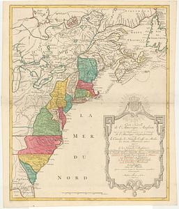
Carte nouvelle de l'Amerique angloise contenant tout ce que les anglois possedent sur le continent de l'Amerique Septentrionale...
44.
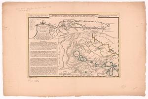
Carte physique des terreins les plus eleves de la partie occidentale du Canada : ou l'on voit les nouvelles decouveres des...
45.
Cours du fleuve St. Laurent : deuxieme feuille : depuis Quebec jusqu'au havre des Papinachouas
46.
Cours du fleuve St. Laurent : premiere feuille : contenant depuis le Lac Ontario jusqu'a Quebec
47.
Cours du fleuve St. Laurent : troisieme feuille : depuis le mont Camille jusqu'a l'isle d'Anticosti
48.
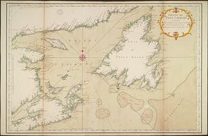
Golphe de Saint Laurent, contenant l'Isle de Terreneuve, Detroit de Belle-Isle, entrée du Fleuve St. Laurent, Isle Royale, et...
49.
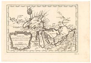
Karte von den seen in Canada zur allgemeinen historie der reisen
50.
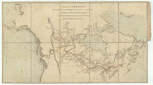
A map exhibiting all the new discoveries in the interior parts of North America inscribed by permission to the honorable...
51.
A map exhibiting all the new discoveries in the interior parts of North America inscribed by permission to the honorable...
52.
A map of America, between latitudes 40 and 70 north, and longitudes 45 and 180 west : exhibiting Mackenzie's track from...
53.
A map of Canada and the north part of Louisiana with the adjacent countrys
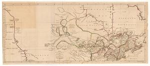
54.
A map of part of Canada for the use of His Majesty's Secretary of State, compiled in the Surveyor Generals Office, pursuant to...
55.
A map of the British and French dominions in North America : with the roads, distances, limits, and extent of the settlements,...
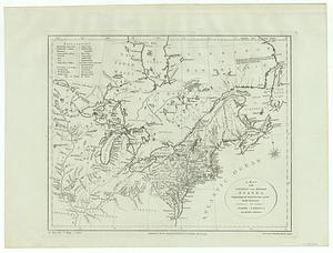
56.
A map of the northern and middle states : comprehending the western territory and the British dominions in North America from...
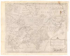
57.
A map of the northern and middle states : comprehending the western territory and the British dominions in North America ;...
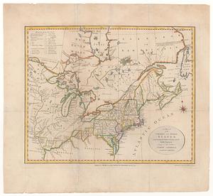
58.
A map of the northern and middle states : comprehending the western territory and the British dominions in North America, from...
59.
A map of the northern and middle states : comprehending the western territory and the British dominions in North America :...
60.
A new and accurate map of the British dominions in America, according to the treaty of 1763 : divided into the several...
‹ Prev
Next ›
1
2
3
4
5
6
7
…
437
438