Toggle navigation
LMEC Home
Exhibitions
Georeferencing
Tools for Teachers
Collections
My Favorites
Sign Up / Log In
Search
Search the map portal
Map Collection
Map Collection
Map Sets
Search
Search
Search for
Search In
All Fields
Creator
Title
Subject
Place
Search All Digital Collections
Advanced Search
8733 Results
My Search
Start Over
More Like
commonwealth:tt44pw742
Remove constraint More Like: commonwealth:tt44pw742
Filter your Search
Place
North and Central America
5,964
United States
4,882
Massachusetts
2,080
Europe
1,396
Suffolk (county)
1,084
Boston
1,057
Canada
449
Asia
438
more
Place
»
Topic
Boston (Mass.)--Maps
587
United States--Maps
282
Real property--Massachusetts--Boston--Maps
180
Massachusetts--Maps
162
Landowners--Massachusetts--Boston--Maps
138
North America--Maps--Early works to 1800
103
New England--Maps
102
City planning--Massachusetts--Boston--Maps
97
more
Topic
»
Date
Date range begin
–
Date range end
Current results range from
1482
to
2023
View distribution
Creator
United States. Hydrographic Office
595
O.H. Bailey & Co
148
Des Barres, Joseph F. W. (Joseph Frederick Wallet), 1722-1824
123
United States. Post Office Dept
120
Boston Redevelopment Authority
100
Ptolemy, 2nd cent
100
Walling, Henry Francis, 1825-1888
94
Geological Survey (U.S.)
86
more
Creator
»
Format
Maps/Atlases
8,673
Manuscripts
215
Prints
56
Books
36
Objects/Artifacts
10
Drawings/Illustrations
8
Posters
5
Georeferenced
Yes
870
No
7,863
Collection
Norman B. Leventhal Map & Education Center Collection
8,696
Boston and New England Maps
2,266
Urban Maps
2,055
Maritime Charts and Atlases
1,083
American Revolutionary War-Era Maps
616
Boston Redevelopment Authority Collection
119
Massachusetts Real Estate Atlases
5
Applied Geographics, Inc. Records
1
more
Collection
»
Available to use
No known restrictions
8,585
Creative Commons license
48
Search Constraints
Sort by relevance
relevance
title
date (asc)
date (desc)
Number of results to display per page
20 per page
10
per page
20
per page
50
per page
100
per page
View results as:
grid view
map view
Search Results
7781.
Stroudsburg : Pennsylvania
7782.
Structure map of northeastern Oklahoma
7783.
Study of plan for the extension of Commonwealth Avenue on the line of Beacon Street
7784.
Sturbridge and Fiskdale, Massachusetts
7785.
Subject nationalities of the German alliance : from the Allies' peace terms as stated in their reply to President Wilson's note...
7786.
Submarine cable chart of the world : showing also the seacoast stations and the principal connecting land lines ; for the use...
7787.
Suburban Boston teachers are the highest earners
7788.
Suburban Boston teachers are the lowest earners
7789.
Südamerika
7790.
Sudan
7791.
Süddeutschland, Österreich, Schweiz und östliches Frankreich
7792.
Suessones : Evesche de Soissons : où sont les Balliages et eslections de Soissons, Chasteau Thierry, et Crespy en Valois &c
7793.
Suffolcia vernacula Suffolke
7794.
Suggestion for the improvement of Muddy River and for completing a continuous promenade from the Common to Jamaica Pond
7795.
Sulu Sea, Cagayan Sulu and adjacent islands
7796.
Sumatra wegenkaart
7797.
Summer resorts of the coast, lake, and mountain regions along the Boston & Maine Railroad and connections
7798.
Sunapee Lake, New Hampshire
7799.
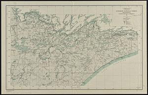
Superior National Forest, Minnesota, fourth principal meridian, 1928
7800.
Supplement pour les Isles Antilles, extrait des carte Angloises
‹ Prev
Next ›
1
2
…
386
387
388
389
390
391
392
393
394
…
436
437