Subject nationalities of the German alliance : from the Allies' peace terms as stated in their reply to President Wilson's note of 19th Dec. 1916
Item Information
- Title:
- Subject nationalities of the German alliance : from the Allies' peace terms as stated in their reply to President Wilson's note of 19th Dec. 1916
- Editor:
- Langhans, Paul, 1867-1952
- Publisher:
- Edward Stanford Ltd.
- Date:
-
[1917?]
- Format:
-
Maps/Atlases
- Location:
-
Boston Public Library
Norman B. Leventhal Map & Education Center - Collection (local):
-
Norman B. Leventhal Map & Education Center Collection
- Subjects:
-
Nationalism--Eurasia--Maps
World War, 1914-1918--Eurasia--Maps
Eurasia--Population--Maps
- Places:
-
Eurasia (area)
- Extent:
- 1 map : color ; 71 x 92 cm
- Terms of Use:
-
No known copyright restrictions.
No known restrictions on use.
- Publisher:
-
London :
Stanford's Geographical Establishment
- Scale:
-
Scale approximately 1:4,300,000
- Language:
-
English
- Notes:
-
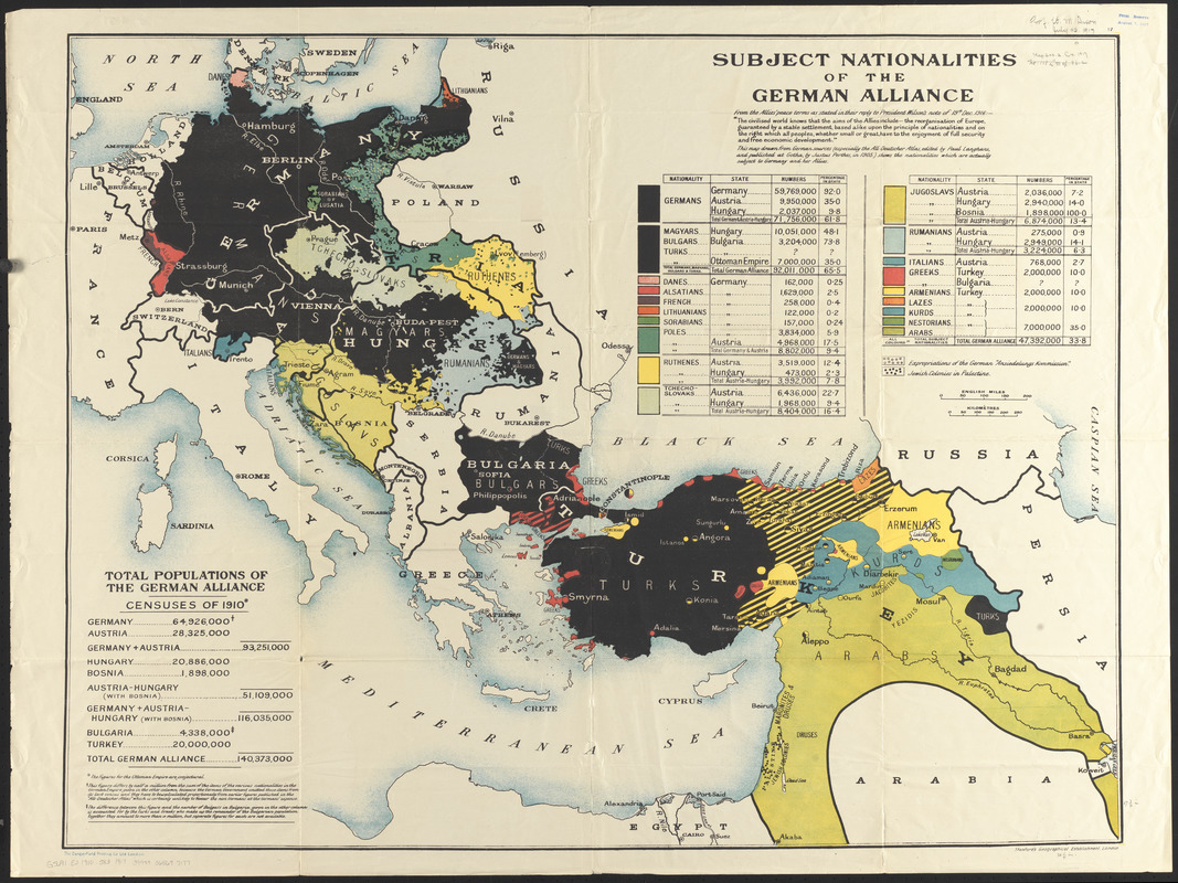
This map drawn from German sources (especially the All-Deutscher Atlas edited by Paul Langhans and published at Gotha by Justus Perthes in 1905) shows the nationalities which are actually subject to Germany and her Allies.
Includes text, statistics of "Total populations of the German alliance, censuses of 1910," and tables showing populations by nationality.
- Identifier:
-
06_01_012642
- Call #:
-
G5691.E2 1910 .S83 1917
- Barcode:
-
39999065697177


