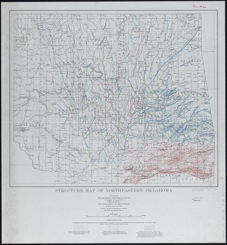
Structure map of northeastern Oklahoma
Item Information
- Title:
- Structure map of northeastern Oklahoma
- Cartographer:
- Oklahoma Geological Survey
- Cartographer:
- Thom, W. T. (William Taylor), 1891-1979
- Contributor:
- Geological Survey (U.S.)
- Name on Item:
-
prepared by the Oklahoma Geological Survey ... in cooperation with the Department of the Interior, United States Geological Survey ; structure contours compiled by W. T. Thom, Jr. assisted by A. A. Baker ... [and others]
- Date:
-
[1925]
- Format:
-
Maps/Atlases
- Genre:
-
Geological maps
- Location:
-
Boston Public Library
Norman B. Leventhal Map & Education Center - Collection (local):
-
Norman B. Leventhal Map & Education Center Collection
- Subjects:
-
Oklahoma--Maps
Geology, Structural--Oklahoma--Maps
- Places:
-
Oklahoma
- Extent:
- 1 map : color ; 50 x 59 cm
- Terms of Use:
-
No known copyright restrictions.
No known restrictions on use.
- Publisher:
-
[Norman, Okla.?] :
Oklahoma Geological Survey
- Scale:
-
Scale 1:500,000
- Language:
-
English
- Notes:
-
Relief shown by contours.
"The structure is shown by generalized contours which indicate the position of the top of the Bartlesville sand, 'Mississippi lime', and 'Wilcox' sand."
- Notes (date):
-
This date is inferred.
- Identifier:
-
06_01_018321
- Call #:
-
G4021.C55 1925 .O35
- Barcode:
-
39999065681668


