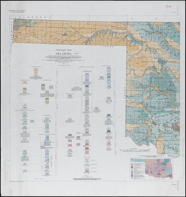
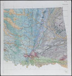
Geologic map of Oklahoma

Item Information
- Title:
- Geologic map of Oklahoma
- Cartographer:
- Miser, Hugh D. (Hugh Dinsmore), 1884-1969
- Cartographer:
- Pusey, Lewis B.
- Cartographer:
- Stose, George Willis, 1869-1960
- Publisher:
- Geological Survey (U.S.)
- Contributor:
- Oklahoma Geological Survey
- Name on Item:
-
compiled by Hugh D. Miser ; geologic drafting by Lewis B. Pusey and others ; edited by George W. Stose
- Date:
-
1926
- Format:
-
Maps/Atlases
- Genre:
-
Geological maps
- Location:
-
Boston Public Library
Norman B. Leventhal Map & Education Center - Collection (local):
-
Norman B. Leventhal Map & Education Center Collection
- Subjects:
-
Oklahoma--Maps
Geology--Oklahoma--Maps
- Places:
-
Oklahoma
- Extent:
- 1 map on 2 sheets : color ; 78 x 158 cm, sheets 92 x 87 cm
- Terms of Use:
-
No known copyright restrictions.
No known restrictions on use.
- Publisher:
-
[Washington, D.C.] :
U.S. Geological Survey
- Scale:
-
Scale 1:500,000
- Language:
-
English
- Notes:
-
Prepared in 1923 and 1924 in cooperation with the geologists of Oklahoma ... ; the oil companies of Oklahoma; and the Oklahoma Geological Survey.
Compiled from published maps, unpublished maps in the records of the United States and Oklahoma Geological Surveys, data furnished by oil companies and consulting geologists, and field data obtained by H.D. Miser.
Includes "Key map showing the sources of information from which the geologic map was compiled."
- Identifier:
-
06_01_018320_A
06_01_018320_B
- Call #:
-
G4021.C5 1926 .M57
- Barcode:
-
39999065681627


