Toggle navigation
LMEC Home
Exhibitions
Georeferencing
Tools for Teachers
Collections
My Favorites
Sign Up / Log In
Search
Search the map portal
Map Collection
Map Collection
Map Sets
Search
Search
Search for
Search In
All Fields
Creator
Title
Subject
Place
Search All Digital Collections
Advanced Search
8786 Results
My Search
Start Over
More Like
commonwealth:tt44pw23k
Remove constraint More Like: commonwealth:tt44pw23k
Filter your Search
Place
North and Central America
6,017
United States
4,934
Massachusetts
2,089
Europe
1,396
Suffolk (county)
1,136
Boston
1,109
Canada
449
Asia
438
more
Place
»
Topic
Boston (Mass.)--Maps
607
United States--Maps
282
Real property--Massachusetts--Boston--Maps
253
Landowners--Massachusetts--Boston--Maps
169
Massachusetts--Maps
163
City planning--Massachusetts--Boston--Maps
118
North America--Maps--Early works to 1800
103
New England--Maps
102
more
Topic
»
Date
Date range begin
–
Date range end
Current results range from
1482
to
2023
View distribution
Creator
United States. Hydrographic Office
595
O.H. Bailey & Co
148
Des Barres, Joseph F. W. (Joseph Frederick Wallet), 1722-1824
123
United States. Post Office Dept
120
Boston Redevelopment Authority
119
Ptolemy, 2nd cent
100
Walling, Henry Francis, 1825-1888
94
Geological Survey (U.S.)
87
more
Creator
»
Format
Maps/Atlases
8,726
Manuscripts
215
Prints
56
Books
36
Objects/Artifacts
10
Drawings/Illustrations
8
Posters
5
Georeferenced
Yes
870
No
7,916
Collection
Norman B. Leventhal Map & Education Center Collection
8,695
Boston and New England Maps
2,288
Urban Maps
2,078
Maritime Charts and Atlases
1,083
American Revolutionary War-Era Maps
616
Boston Redevelopment Authority Collection
142
Massachusetts Real Estate Atlases
36
Applied Geographics, Inc. Records
1
Available to use
No known restrictions
8,608
Creative Commons license
47
Search Constraints
Sort by relevance
relevance
title
date (asc)
date (desc)
Number of results to display per page
20 per page
10
per page
20
per page
50
per page
100
per page
View results as:
grid view
map view
Search Results
5181.
A new and accurate chart of the Bay of Chesapeak including Delaware Bay with all the shoals, channels, islands, entrances,...
5182.
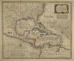
A new and accurate chart of the West Indies : with the adjacent coasts of North and South America
5183.
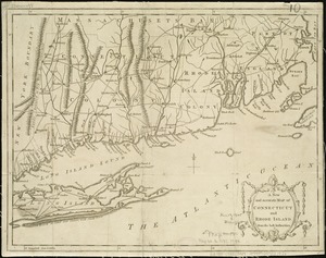
A new and accurate map of Connecticut and Rhode Island, from the best authorities
5184.
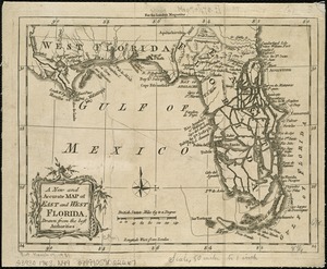
A New and accurate map of East and West Florida, drawn from the best authorities
5185.
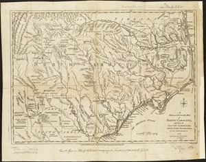
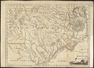
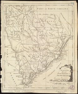
A new and accurate map of North Carolina, and part of South Carolina, with the field of battle between Earl Cornwalis and...
5186.
A new and accurate map of North Carolina in North America
5187.
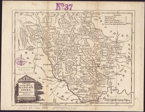
A New and accurate map of Radnor Shire
5188.
A new and accurate map of the colony of Massachusets Bay, in North America, from a late survey
5189.
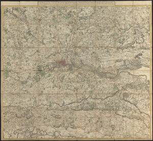
A new and accurate map of the country twenty-five miles round London : on which are delineated from an actual survey, His...
5190.
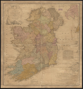
A new and accurate map of the kingdom of Ireland divided into provinces, counties & baronies : with all the cities, boroughs,...
5191.
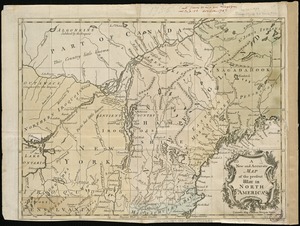
A new and accurate map of the present seat of war in North America
5192.
A New and accurate map of the present seat of war in North America, comprehending New Jersey, Philadelphia, Pensylvania,...
5193.
A new and accurate map of the present war in North America
5194.
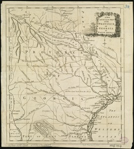
A New and accurate map of the province of Georgia in North America
5195.
A new and accurate map of the province of New York and part of the Jerseys, New England and Canada, shewing the scenes of our...
5196.
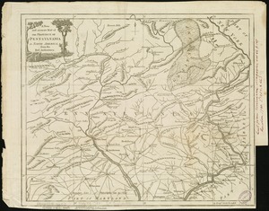
A new and accurate map of the province of Pennsylvania in North America, from the best authorities
5197.
A New and accurate map of the province of South Carolina in North America
5198.
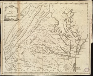
A new and accurate map of the province of Virginia in North America
5199.
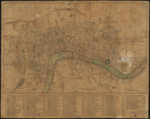
A new and accurate plan of London, Westminster and the Borough of Southwark, with all the additional streets, squares, &c :...
5200.
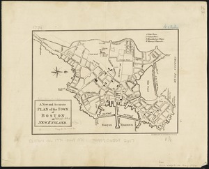
A new and accurate plan of the town of Boston in New England
‹ Prev
Next ›
1
2
…
256
257
258
259
260
261
262
263
264
…
439
440