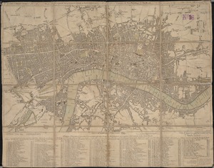
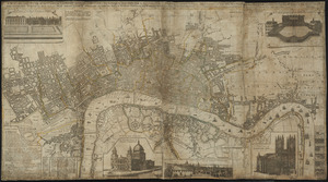
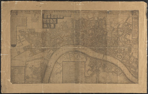
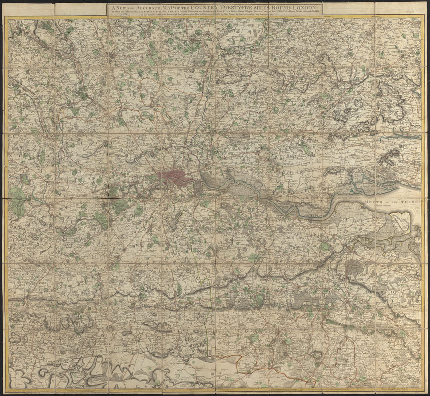
A new and accurate map of the country twenty-five miles round London : on which are delineated from an actual survey, His Majesty's palaces, noblemen and gentlemen's seats, cities, market towns, villages, churches, cottages, rivers, mills, parks, woods, heaths & remarkable hills, all the turnpike and cross roads; with the distances from place to place, according to the mile stones by John Andrews, land surveyor, 1783
Item Information
- Title:
- A new and accurate map of the country twenty-five miles round London : on which are delineated from an actual survey, His Majesty's palaces, noblemen and gentlemen's seats, cities, market towns, villages, churches, cottages, rivers, mills, parks, woods, heaths & remarkable hills, all the turnpike and cross roads; with the distances from place to place, according to the mile stones by John Andrews, land surveyor, 1783
- Title (alt.):
-
Map of twenty five miles round, London
- Cartographer:
- Andrews, John, 1736-1809
- Publisher:
- Dury, Andrew
- Name on Item:
-
drawn & engraved by John Andrews
- Date:
-
[1783]
- Format:
-
Maps/Atlases
- Location:
-
Boston Public Library
Norman B. Leventhal Map & Education Center - Collection (local):
-
Norman B. Leventhal Map & Education Center Collection
- Subjects:
-
London (England)--Maps--Early works to 1800
- Places:
-
EnglandLondon
- Extent:
- 1 map : hand colored ; 119 x 133 cm
- Terms of Use:
-
No known copyright restrictions.
No known restrictions on use.
- Publisher:
-
London :
John Andrews, Andrew Dury
- Scale:
-
Scale approximately 1:73,600
- Language:
-
English
- Notes:
-
Relief shown by hachures.
"Publish'd as the Act directs, Septr. 10th. 1777."
Prime meridians: St. Paul's and [Greenwich].
- Notes (date):
-
This date is inferred.
- Identifier:
-
06_01_014372
- Call #:
-
G5754.L7 1783 .A53
- Barcode:
-
39999065701300