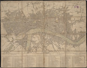
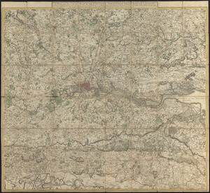
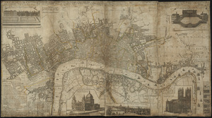
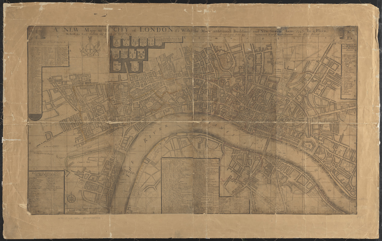
A new mapp of the city of London &c. with the many additionall buildings and new streets anno 1745 in a plain
Item Information
- Title:
- A new mapp of the city of London &c. with the many additionall buildings and new streets anno 1745 in a plain
- Printer:
- Bakewell, Thomas, -1749
- Date:
-
1745
- Format:
-
Maps/Atlases
- Location:
-
Boston Public Library
Norman B. Leventhal Map & Education Center - Collection (local):
-
Norman B. Leventhal Map & Education Center Collection
- Subjects:
-
London (England)--Maps--Early works to 1800
- Places:
-
EnglandLondon
- Extent:
- 1 map : col. ; 59 x 104 cm.
- Terms of Use:
-
No known copyright restrictions.
No known restrictions on use.
- Publisher:
-
London :
Printed and sold by Tho. Bakewell
- Scale:
-
Scale [ca. 1:7,300]
- Language:
-
English
- Notes:
-
Shows names of streets, drainage; buildings, parks, and other points of interest shown pictorially.
Includes 5 indexes or tables: The names of the severall wards into which this city is divided -- The rates for watermen as they are set forth by the Lord Mayer and court of Aldermen -- The rates of hackney-coaches and chairs, according to Act of Parliment -- Refferences to letters to find the most publick buildings -- Refferences by figures to the severall churches in and about this city.
Includes illus. for: The coats of arms of the 12 first companies out of which the Lord Mayer must be chosen.
Ill. of 2 griffins holding coat-of-arms.
- Identifier:
-
06_01_007013
- Call #:
-
G5754.L7 1745 .N49x
- Barcode:
-
39999059029122