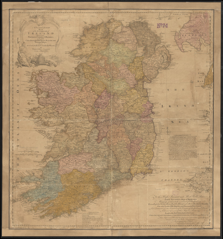
A new and accurate map of the kingdom of Ireland divided into provinces, counties & baronies : with all the cities, boroughs, post-towns, barracks, and principal villages : also the great, the branch, & the by-post roads
Item Information
- Title:
- A new and accurate map of the kingdom of Ireland divided into provinces, counties & baronies : with all the cities, boroughs, post-towns, barracks, and principal villages : also the great, the branch, & the by-post roads
- Cartographer:
- Jefferys, Thomas, -1771
- Name on Item:
-
by Thomas Jefferys
- Date:
-
[1759]
- Format:
-
Maps/Atlases
- Location:
-
Boston Public Library
Norman B. Leventhal Map & Education Center - Collection (local):
-
Norman B. Leventhal Map & Education Center Collection
- Subjects:
-
Ireland--Maps--Early works to 1800
- Places:
-
Ireland
- Extent:
- 1 map : col. ; 62 x 59 cm.
- Terms of Use:
-
No known copyright restrictions.
No known restrictions on use.
- Publisher:
-
London :
T. Jefferys
- Scale:
-
Scale [ca. 1:824,000]
- Language:
-
English
- Notes:
-
Conservation of this piece was funded by Arend Sluis and Mark Mulligan.
Relief shown pictorially.
Includes advertisement and dedication.
- Notes (date):
-
This date is inferred.
- Identifier:
-
06_01_007035
- Call #:
-
G5780 1759 .J44x
- Barcode:
-
39999059029221


