Toggle navigation
LMEC Home
Exhibitions
Georeferencing
Tools for Teachers
Collections
My Favorites
Sign Up / Log In
Search
Search the map portal
Map Collection
Map Collection
Map Sets
Search
Search
Search for
Search In
All Fields
Creator
Title
Subject
Place
Search All Digital Collections
Advanced Search
8719 Results
My Search
Start Over
More Like
commonwealth:tt44pv58g
Remove constraint More Like: commonwealth:tt44pv58g
Filter your Search
Place
North and Central America
6,013
United States
4,937
Massachusetts
2,067
Europe
1,359
Suffolk (county)
1,191
Boston
1,164
Canada
448
Asia
422
more
Place
»
Topic
Boston (Mass.)--Maps
601
United States--Maps
278
Real property--Massachusetts--Boston--Maps
253
City planning--Massachusetts--Boston--Maps
172
Landowners--Massachusetts--Boston--Maps
169
Massachusetts--Maps
160
North America--Maps--Early works to 1800
103
New England--Maps
101
more
Topic
»
Date
Date range begin
–
Date range end
Current results range from
1482
to
2023
View distribution
Creator
United States. Hydrographic Office
594
Boston Redevelopment Authority
174
O.H. Bailey & Co
148
Des Barres, Joseph F. W. (Joseph Frederick Wallet), 1722-1824
123
United States. Post Office Dept
120
Ptolemy, 2nd cent
100
Walling, Henry Francis, 1825-1888
94
Geological Survey (U.S.)
86
more
Creator
»
Format
Maps/Atlases
8,660
Manuscripts
215
Prints
56
Books
36
Objects/Artifacts
10
Drawings/Illustrations
8
Posters
4
Georeferenced
Yes
871
No
7,848
Collection
Norman B. Leventhal Map & Education Center Collection
8,568
Boston and New England Maps
2,328
Urban Maps
2,057
Maritime Charts and Atlases
1,081
American Revolutionary War-Era Maps
616
Boston Redevelopment Authority Collection
203
Massachusetts Real Estate Atlases
35
Applied Geographics, Inc. Records
2
more
Collection
»
Available to use
No known restrictions
8,542
Creative Commons license
47
Search Constraints
Sort by relevance
relevance
title
date (asc)
date (desc)
Number of results to display per page
20 per page
10
per page
20
per page
50
per page
100
per page
View results as:
grid view
map view
Search Results
181.
South Cove : property status and unit ownership
182.
Boston with Charlestown and Roxbury
183.
Illustrative site plan : Washington Park urban renewal area, Massachusetts R-24
184.
Insurance maps of Boston volume two
185.
Map of Dorchester, Roxbury, and West Roxbury
186.
Map of the town of Roxbury : surveyed by order of the town authorities
187.
Map of the town of Roxbury
188.
A new & complete map of the city of Boston, with part of Charlestown, Cambridge & Roxbury
189.
A new & complete map of the city of Boston, with part of Charlestown, Cambridge & Roxbury
190.
A new & complete map of the city of Boston, with part of Charlestown, Cambridge & Roxbury
191.
Parcel 22
192.
Plan of Boston and Roxbury
193.
Plan of the Roxbury Canal lands belonging to the city of Boston to be sold by public auction on Saturday May 19th 1883 at 3...
194.
A plan of the salt marsh and upland in Roxbury, lying the east side of the Mill Creek
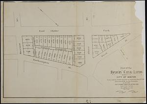
195.
Topographical map of Cedar Square, Roxbury
196.
Views of the area around Dudley Station in Roxbury
197.
Woodland Cemetery in Dorchester and Roxbury main entrance on Walk-Hill Street : five miles from Boylston market, direct route...
198.
Boston urban wilds : ownership
199.
Historical map of the north and central parts of Old Boston : with explanatory key
200.
Plan accompanying the proposal made to the City of Boston by the Commissioners on Boston Harbor and the Back Bay Octr. 20, 1854...
‹ Prev
Next ›
1
2
…
6
7
8
9
10
11
12
13
14
…
435
436