Toggle navigation
LMEC Home
Exhibitions
Georeferencing
Tools for Teachers
Collections
My Favorites
Sign Up / Log In
Search
Search the map portal
Map Collection
Map Collection
Map Sets
Search
Search
Search for
Search In
All Fields
Creator
Title
Subject
Place
Search All Digital Collections
Advanced Search
9088 Results
My Search
Start Over
More Like
commonwealth:t722mh264
Remove constraint More Like: commonwealth:t722mh264
Filter your Search
Place
North and Central America
6,319
United States
5,237
Massachusetts
2,151
Suffolk (county)
1,439
Boston
1,412
Europe
1,396
Canada
449
Asia
438
more
Place
»
Topic
Boston (Mass.)--Maps
685
City planning--Massachusetts--Boston--Maps
418
United States--Maps
282
Real property--Massachusetts--Boston--Maps
253
Urban renewal--Massachusetts--Boston--Maps
253
Landowners--Massachusetts--Boston--Maps
169
Massachusetts--Maps
162
Buildings--Massachusetts--Boston--Maps
124
more
Topic
»
Date
Date range begin
–
Date range end
Current results range from
1482
to
2023
View distribution
Creator
United States. Hydrographic Office
595
Boston Redevelopment Authority
392
O.H. Bailey & Co
148
Des Barres, Joseph F. W. (Joseph Frederick Wallet), 1722-1824
123
United States. Post Office Dept
120
Ptolemy, 2nd cent
100
Walling, Henry Francis, 1825-1888
94
Geological Survey (U.S.)
86
more
Creator
»
Format
Maps/Atlases
9,028
Manuscripts
215
Prints
56
Books
36
Objects/Artifacts
10
Drawings/Illustrations
8
Posters
5
Georeferenced
Yes
869
No
8,219
Collection
Norman B. Leventhal Map & Education Center Collection
8,695
Boston and New England Maps
2,591
Urban Maps
2,379
Maritime Charts and Atlases
1,083
American Revolutionary War-Era Maps
616
Boston Redevelopment Authority Collection
445
Massachusetts Real Estate Atlases
35
Applied Geographics, Inc. Records
1
Available to use
No known restrictions
8,911
Creative Commons license
47
Search Constraints
Sort by relevance
relevance
title
date (asc)
date (desc)
Number of results to display per page
20 per page
10
per page
20
per page
50
per page
100
per page
View results as:
grid view
map view
Search Results
6541.
Plan des paroisses de Paris : avec la distinction des parties eparses qui de dépendent
6542.
Plan des ports et ville d'Alexandrie
6543.
Plan du Bois de Boulogne
6544.
Plan du palais et du parc de Versailles
6545.
Plan du port et de la ville de Boulogne
6546.
Plan et profil au naturel de la ville d'Orleans
6547.
Plan for a complete new harbour, at Howth-town, for the use of his Majesty's mail packet-boats, fishing vessels & in case of a...
6548.
Plan for laying out the village of Oak Bluffs, Martha's Vineyard
6549.
[Plan for proposed Charles River Park]
6550.
Plan for the diversion and enclosure of Stony Brook : to accompany report of W.H. Bradley, November 1864
6551.
Plan for the improvement of the Central Park, adopted by the Commissioners, June 3rd, 1856
6552.
Plan for the occupation of flats owned by the Commonwealth in Boston Harbor
6553.
Plan for the occupation of flats owned by the Commonwealth in Boston Harbor
6554.
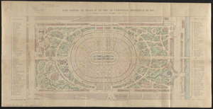
Plan général du palais et du parc de l'Exposition universelle de 1867
6555.
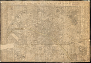
Plan géométral de Paris et de ses fauxbourgs
6556.
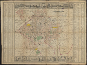
Plan géométrique de la ville de Bruxelles
6557.
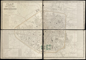
Plan illustré de la Ville de Bruxelles, comprenant les quartiers nouveaux & tous les agrandissements décrétés & projetés
6558.
Plan Moose River gold district, Halifax Co., N.S
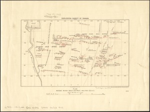
6559.
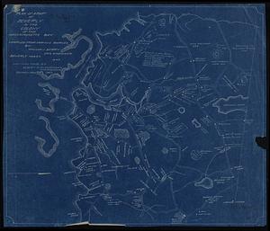
Plan of a part of Beverly in the Colony of the Massachusetts Bay
6560.
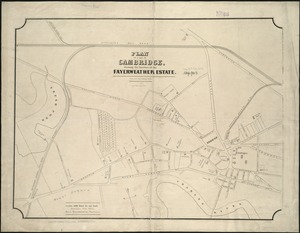
Plan of a part of Cambridge showing the location of the Fayerweather Estate
‹ Prev
Next ›
1
2
…
324
325
326
327
328
329
330
331
332
…
454
455
![[Plan for proposed Charles River Park]](https://bpldcassets.blob.core.windows.net/derivatives/images/commonwealth:cf95jc91c/image_thumbnail_300.jpg)