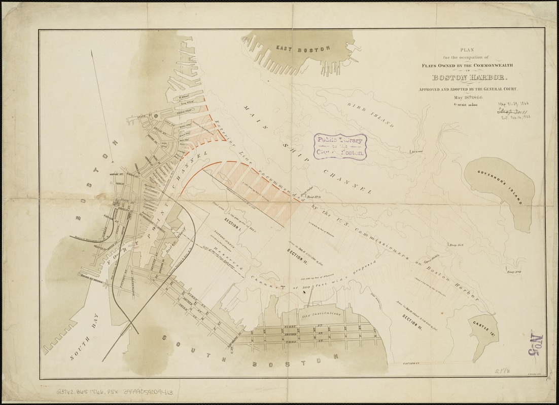
Plan for the occupation of flats owned by the Commonwealth in Boston Harbor
Item Information
- Title:
- Plan for the occupation of flats owned by the Commonwealth in Boston Harbor
- Date:
-
[1866]
- Format:
-
Maps/Atlases
- Location:
-
Boston Public Library
Norman B. Leventhal Map & Education Center - Collection (local):
-
Norman B. Leventhal Map & Education Center Collection
- Subjects:
-
Harbors--Massachusetts--Boston--Maps
Boston Harbor (Mass.)--Maps
- Places:
-
MassachusettsBoston Harbor
- Extent:
- 1 map : col. ; 38 x 53 cm.
- Terms of Use:
-
No known copyright restrictions.
No known restrictions on use.
- Publisher:
-
Boston :
Board of Harbor Commissioners
- Scale:
-
Scale 1:10,000.
- Language:
-
English
- Notes:
-
Oriented with north toward the upper left.
"Approved and adopted by the General Court, May 18th 1866."
- Notes (date):
-
This date is inferred.
- Identifier:
-
06_01_005091
- Call #:
-
G3762.B65 1866 .P5
- Barcode:
-
39999059009413


