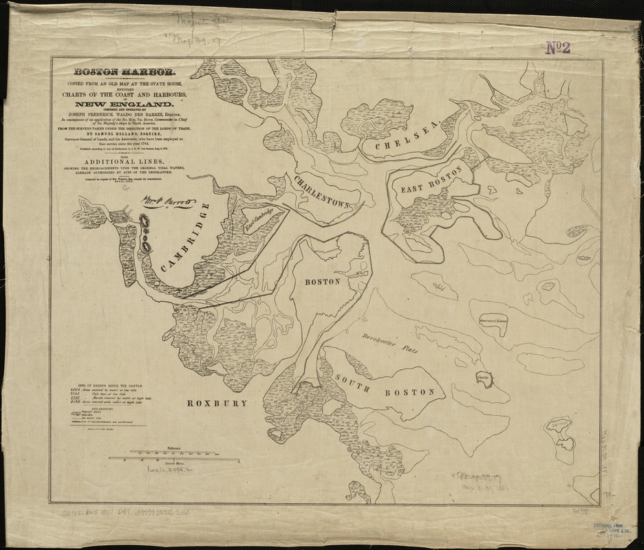
Boston Harbor
Item Information
- Title:
- Boston Harbor
- Creator:
- Des Barres, Joseph F. W. (Joseph Frederick Wallet), 1722-1824
- Name on Item:
-
copied from an old map at the State House entitled Charts of the coast and harbours, of New England, composed and engraved by Joseph Frederick Waldo Des Barres ... 1764 ; with additional lines showing the encroachments upon the original tidal waters ... compiled by request of Wm. Whiting ... April, 1851.
- Date:
-
[1851?]
- Format:
-
Maps/Atlases
- Location:
-
Boston Public Library
Norman B. Leventhal Map & Education Center - Collection (local):
-
Norman B. Leventhal Map & Education Center Collection
- Subjects:
-
Harbors--Massachusetts--Boston--Maps
Boston Harbor (Mass.)--Maps
- Places:
-
MassachusettsBoston Harbor
- Extent:
- 1 map ; 45 x 55 cm.
- Terms of Use:
-
No known copyright restrictions.
No known restrictions on use.
- Publisher:
-
Boston :
Powers & Co., lith
- Scale:
-
Scale 1:25,344.
- Language:
-
English
- Notes:
-
Relief shown by hachures.
Detached from: Whiting, William. The destruction of Boston Harbor. Boston : J.M. Hewes & Co., 1852.
- Identifier:
-
06_01_004934
- Call #:
-
G3762.B65 1851 .D47
- Barcode:
-
39999059009033


