Plan et profil au naturel de la ville d'Orleans
Item Information
- Title:
- Plan et profil au naturel de la ville d'Orleans
- Description:
-
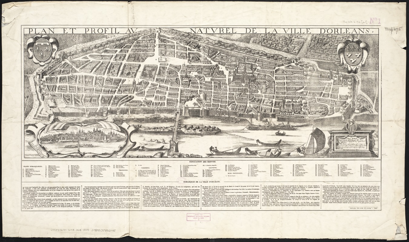
France and England had a fractured relationship during the Renaissance, as the two sides battled regularly against one another for control of French lands. The town of Orléans, depicted in this view originally from 1648, was the site of a famous siege in 1429. It was here that young Joan of Arc (Joan La Pucelle) rallied the French army behind her, and overtook Orléans from the English. In its villainizing of the French characters and triumph of English heroes, Henry VI, Part I supported a feeling of pride in country and monarch in England under Elizabeth I.
- Creator:
- Hotot, Gilles.
- Name on Item:
-
vôtre obeissant seruiteur G. Hotot.
- Date:
-
1849
- Format:
-
Maps/Atlases
- Location:
-
Boston Public Library
Norman B. Leventhal Map & Education Center - Collection (local):
-
Norman B. Leventhal Map & Education Center Collection
- Subjects:
-
Orléans (France)--Aerial views--Early works to 1800--Facsimiles
- Places:
-
FranceCentre (region)Orléans
- Extent:
- 1 view ; 27 x 72 cm.
- Terms of Use:
-
No known copyright restrictions.
No known restrictions on use.
- Publisher:
-
Olréans :
A. Jacob
- Scale:
-
Not drawn to scale.
- Language:
-
French
- Notes:
-
Facsimile.
Bird's-eye view.
Includes index to points of interest.
Original version: Olréans : Gilles Hotot, [1648].
- Notes (exhibitions):
-
Exhibited: "Shakespeare’s Here and Everywhere" organized by the Norman B. Leventhal Map Center at the Boston Public Library, 2016-2017.
- Identifier:
-
06_01_003794
- Call #:
-
G5834.O6A3 1648 .H68 1849
- Barcode:
-
39999059002145


