Toggle navigation
LMEC Home
Exhibitions
Georeferencing
Tools for Teachers
Collections
My Favorites
Sign Up / Log In
Search
Search the map portal
Map Collection
Map Collection
Map Sets
Search
Search
Search for
Search In
All Fields
Creator
Title
Subject
Place
Search All Digital Collections
Advanced Search
9057 Results
My Search
Start Over
More Like
commonwealth:rv045b15k
Remove constraint More Like: commonwealth:rv045b15k
Filter your Search
Place
North and Central America
6,288
United States
5,206
Massachusetts
2,152
Suffolk (county)
1,408
Europe
1,396
Boston
1,381
Canada
449
Asia
438
more
Place
»
Topic
Boston (Mass.)--Maps
680
City planning--Massachusetts--Boston--Maps
418
United States--Maps
282
Urban renewal--Massachusetts--Boston--Maps
253
Real property--Massachusetts--Boston--Maps
221
Massachusetts--Maps
162
Landowners--Massachusetts--Boston--Maps
140
North America--Maps--Early works to 1800
103
more
Topic
»
Date
Date range begin
–
Date range end
Current results range from
1482
to
2023
View distribution
Creator
United States. Hydrographic Office
595
Boston Redevelopment Authority
393
O.H. Bailey & Co
148
Des Barres, Joseph F. W. (Joseph Frederick Wallet), 1722-1824
123
United States. Post Office Dept
120
Ptolemy, 2nd cent
100
Walling, Henry Francis, 1825-1888
94
Geological Survey (U.S.)
86
more
Creator
»
Format
Maps/Atlases
8,997
Manuscripts
215
Prints
56
Books
36
Objects/Artifacts
10
Drawings/Illustrations
8
Posters
5
Georeferenced
Yes
869
No
8,188
Collection
Norman B. Leventhal Map & Education Center Collection
8,696
Boston and New England Maps
2,590
Urban Maps
2,376
Maritime Charts and Atlases
1,083
American Revolutionary War-Era Maps
616
Boston Redevelopment Authority Collection
442
Massachusetts Real Estate Atlases
5
Applied Geographics, Inc. Records
1
more
Collection
»
Available to use
No known restrictions
8,910
Creative Commons license
47
Search Constraints
Sort by relevance
relevance
title
date (asc)
date (desc)
Number of results to display per page
20 per page
10
per page
20
per page
50
per page
100
per page
View results as:
grid view
map view
Search Results
8881.
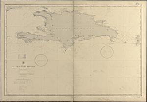
West Indies, island of Santo Domingo, Caldera Bay : from a survey in 1870 by the officers of the U.S.S. Nantasket, Lt. Comdr....
8882.
West Indies, island of Santo Domingo, harbor of Jacmel : from an English survey in 1817
8883.
West Indies, Island of Santo Domingo, Santo Domingo Harbor : surveyed by the officers of H.M.S. Hound, 1849
8884.
West Indies, island of Santo Domingo, the Môle of St. Nicolas : from the latest English survey
8885.
West Indies, Island of Santo Domingo with Mona Passage : compiled from the latest British and Spanish charts, 1886
8886.
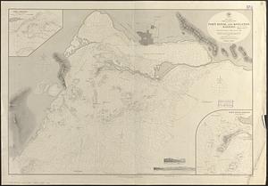
West Indies, Jamaica--south coast, Port Morant : surveyed by Staff Commander G. Stanley, R.N. 1873 ; republication of British...
8887.
West Indies, Jamaica--south coast, Port Royal and Kingston Harbors : from British surveys to 1874, corrected to 1881
8888.
West Indies, Little Bahama Bank, Whale Cay Channel and Green Turtle Cay anchorage : from a British survey in 1882-3
8889.
West Indies, n. coast of St. Domingo, Manzanillo Bay
8890.
West Indies, New Providence Island, Nassau Harbor : from British surveys in 1841, 1866 and 1881
8891.
West Indies, north coast of Cuba, Bahia Honda : from a Spanish plan corrected to 1883 ; West Indies, north coast of Cuba, Port...
8892.
West Indies, north coast of Cuba, Port Matanzas : from a Spanish survey in 1892
8893.
West Indies, north coast of Cuba, Port Matanzas : from a Spanish survey in 1892
8894.
West Indies, north coast of Cuba, Port Tanamo : from a Spanish plan, corrected to 1883 ; West Indies, north coast of Cuba, Port...
8895.
West Indies, north coast of Santo Domingo, Port Plata
8896.
West Indies, port & anchorages on the north east coast of Cuba : from Spanish government surveys in 1867-8
8897.
West Indies, Port San Juan, north side of Porto Rico : from a Spanish survey in 1868, corrected to 1874
8898.
West Indies, ports and anchorages at the eastern end of Cuba : from Spanish government surveys in 1860-74
8899.
West Indies, ports on the north and west coasts of Haiti : from the most recent surveys
8900.
West Indies, ports on the north coast of Cuba : from Spanish government surveys corrected to 1883
‹ Prev
Next ›
1
2
…
441
442
443
444
445
446
447
448
449
…
452
453