Toggle navigation
LMEC Home
Exhibitions
Georeferencing
Tools for Teachers
Collections
My Favorites
Sign Up / Log In
Search
Search the map portal
Map Collection
Map Collection
Map Sets
Search
Search
Search for
Search In
All Fields
Creator
Title
Subject
Place
Search All Digital Collections
Advanced Search
480 Results
My Search
Start Over
More Like
commonwealth:q524nk07j
Remove constraint More Like: commonwealth:q524nk07j
Filter your Search
Place
North and Central America
416
United States
293
New York
40
Florida
19
Canada
17
Alabama
15
Chatham (county)
15
Savannah
13
more
Place
»
Topic
Manuscript maps--Early works to 1800
92
Manuscript maps
21
Gulf Coast (U.S.)--Maps, Manuscript--Early works to 1800
12
Fortification--New York (State)--New York--Maps--Early works to 1800
11
New York (N.Y.)--Buildings, structures, etc--Maps, Manuscript--Early works to 1800
9
New York (N.Y.)--Maps, Manuscript--Early works to 1800
8
Saratoga Campaign, N.Y., 1777--Maps, Manuscript--Early works to 1800
8
Coasts--Florida--Maps--Early works to 1800
7
more
Topic
»
Date
Date range begin
–
Date range end
Current results range from
1700
to
1899
View distribution
Creator
Hills, John, (Surveyor)
17
Montrésor, John, 1736-1799
16
Bingham, William, 1752-1804
12
Adlum, John, 1759-1836
10
Washington, George, 1732-1799
9
Faden, William, 1749-1836
7
Wangenheim, Friedrich Adam Julius von
7
Capitaine du Chesnoy, Michel, 1746-1804
6
more
Creator
»
Format
Maps/Atlases
478
Manuscripts
475
Objects/Artifacts
2
Georeferenced
Yes
5
No
475
Collection
American Revolutionary War-Era Maps
480
Library of Congress Collection
480
Maritime Charts and Atlases
31
Urban Maps
15
Available to use
Creative Commons license
480
Search Constraints
Sort by date (asc)
relevance
title
date (asc)
date (desc)
Number of results to display per page
20 per page
10
per page
20
per page
50
per page
100
per page
View results as:
grid view
map view
Search Results
361.
Plan du terrein à la rive gauche de la rivière de James vis-à-vis Jamestown en Virginie : ou s'est livré le combat du 6...
362.
Plan d'York en Virginie avec les attaques faites par les Armées françoise et américaine en 8bre. 1781
363.
Plan of Fort George at Pensacola
364.
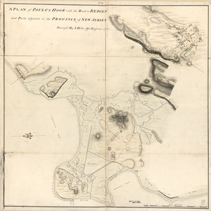
A plan of Paulus Hook with the road to Bergen and parts adjacent in the province of New Jersey
365.
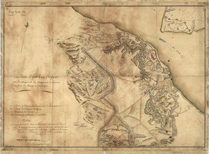
A Plan of the entrance of Chesapeak [sic] Bay, with James and York Rivers : wherein are shewn the respective positions (in the...
366.
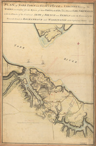
Plan of York Town and Gloucester in Virginia : shewing the works constructed for the defence of those posts by the Rt. Honble:...
367.
Position du camp de l'armée combinée a Philipsburg du 6 juillet au 19 aoust
368.
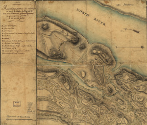
Reconnoissance de King's bridge : I
369.
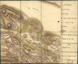
Reconnoissance des ouvrages du nord de l'Isle de Newyork dont on a déterminé géometriquement les principaux points le 22 et...
370.
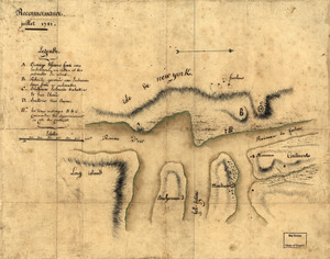
Reconnoissance, juillet 1781
371.
Siege d'York, 1781 : Plan d'York en Virginie avec les attaques et les campemens de l'Armée combinée de France et d'Amérique
372.
Sketch map of fortifications in the vicinity of Fort Washington, Manhattan Island, New York
373.
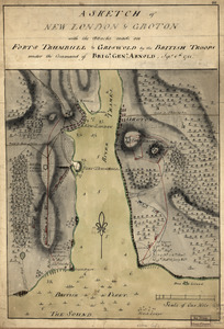
A sketch of New London & Groton with the attacks made on Forts Trumbull & Griswold by the British troops : under the command of...
374.
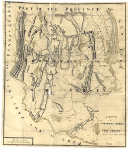
A sketch of the northern parts of New Jersey
375.
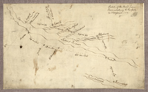
Sketch of the road from Fredericksburg to Norfolk in Virginia
376.
Ville, port, et rade de Baltimore dans le Maryland
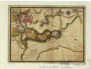
377.
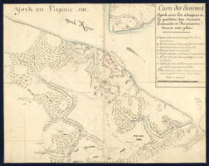
York en Virginie, 1781 : Carte des environs d'York avec les attaques à la position des Armées francaise et americaine devant...
378.
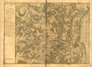
Armée de Rochambeau, 1782 : Carte des environs de Williamsburg en Virginie où les armées françoise et américaine ont...
379.
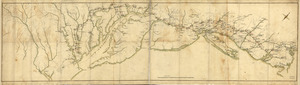
Côte de York-town à Boston: Marches de l'armée
380.
Fort Provost in 1782
‹ Prev
Next ›
1
2
…
15
16
17
18
19
20
21
22
23
24
![A Plan of the entrance of Chesapeak [sic] Bay, with James and York Rivers](https://bpldcassets.blob.core.windows.net/derivatives/images/commonwealth:q524nf233/image_thumbnail_300.jpg)