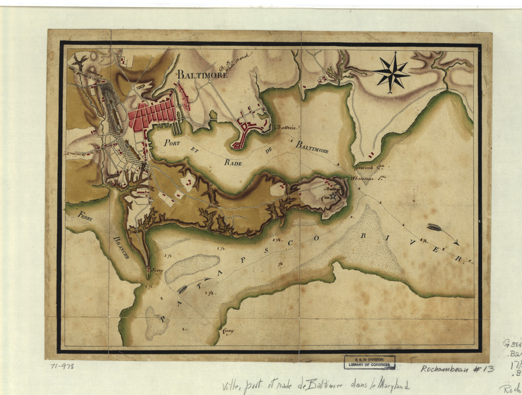
Ville, port, et rade de Baltimore dans le Maryland
This map is also available in American Revolutionary Geographies Online (ARGO), a collections portal especially built for material relating to the American Revolutionary War Era. Visit ARGO to learn more about this item and explore the historical geography of North America in the late eighteenth century.
Item Information
- Title:
- Ville, port, et rade de Baltimore dans le Maryland
- Creator:
- Berthier, Louis-Alexandre, 1753-1815
- Date:
-
[1781?]
- Format:
-
Maps/Atlases
Manuscripts
- Location:
- Library of Congress Geography and Map Division
- Collection (local):
-
Library of Congress Collection
- Subjects:
-
Baltimore (Md.)--Maps, Manuscript--Early works to 1800
Harbors--Maryland--Baltimore--Maps, Manuscript--Early works to 1800
- Places:
-
Baltimore Independent City (county)Baltimore
- Extent:
- 1 manuscript map : hand color 25 x 34 cm.
- Terms of Use:
-
No known copyright restrictions.
This work is licensed for use under a Creative Commons Attribution Non-Commercial Share Alike License (CC BY-NC-SA).

- Scale:
-
Scale ca. 1:26,400
- Language:
-
French
- Catalog Record:
-
https://lccn.loc.gov/gm71000978
- Notes:
-
Manuscript, pen-and-ink and watercolor.
Title from manuscript label on verso as originally mounted.
Relief shown by shading.
Shows fortifications, troop encampments, and roads from "White Marsh," "Frederick Town," and "Spuriens."
- Notes (citation):
-
LC Maps of North America, 1750-1789, 1419
- Identifier:
-
ar141900x


