Toggle navigation
LMEC Home
Exhibitions
Georeferencing
Tools for Teachers
Collections
My Favorites
Sign Up / Log In
Search
Search the map portal
Map Collection
Map Collection
Map Sets
Search
Search
Search for
Search In
All Fields
Creator
Title
Subject
Place
Search All Digital Collections
Advanced Search
542 Results
My Search
Start Over
More Like
commonwealth:q524n7686
Remove constraint More Like: commonwealth:q524n7686
Filter your Search
Place
North and Central America
477
United States
338
New York
41
Canada
26
Boston Harbor
21
Florida
20
Mississippi
18
Alabama
17
more
Place
»
Topic
Manuscript maps--Early works to 1800
138
Manuscript maps
21
Nautical charts--Massachusetts--Boston Harbor--Early works to 1800
16
Gulf Coast (U.S.)--Maps, Manuscript--Early works to 1800
12
Boston Harbor (Mass.)--Maps--Early works to 1800
11
Fortification--New York (State)--New York--Maps--Early works to 1800
11
Nautical charts--Massachusetts--Boston Bay--Early works to 1800
9
New York (N.Y.)--Buildings, structures, etc--Maps, Manuscript--Early works to 1800
9
more
Topic
»
Date
Date range begin
–
Date range end
Current results range from
1688
to
1899
View distribution
Creator
Hills, John, (Surveyor)
18
Montrésor, John, 1736-1799
16
Dumont de Montigny
14
Bingham, William, 1752-1804
12
Adlum, John, 1759-1836
10
Washington, George, 1732-1799
9
Faden, William, 1749-1836
7
Morgan, Benjamin, (Draftsman)
7
more
Creator
»
Format
Maps/Atlases
540
Manuscripts
523
Objects/Artifacts
2
Georeferenced
Yes
9
No
533
Collection
American Revolutionary War-Era Maps
533
Library of Congress Collection
485
Maritime Charts and Atlases
46
Newberry Library Collection
39
Boston and New England Maps
17
Norman B. Leventhal Map & Education Center Collection
17
Urban Maps
17
Mapping Boston Collection
7
more
Collection
»
Available to use
Creative Commons license
493
No known restrictions
10
Search Constraints
Sort by relevance
relevance
title
date (asc)
date (desc)
Number of results to display per page
20 per page
10
per page
20
per page
50
per page
100
per page
View results as:
grid view
map view
Search Results
501.
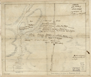
Sketch of the battle of Camden, Augt. 16, 1780
502.
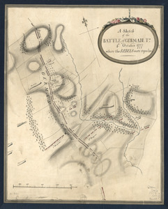
A Sketch of the Battle of German. Tn : 4th. October 1777, where the rebels were repulsed
503.
A Sketch of the Battle of German. Tn : 4th October 1777, where the rebels were repulsed
504.
Sketch of the coast from South Edisto to Charles Town, 1st March 1780
505.
Sketch of the engagement at Trenton : given on the 26th of December 1776 betwixt the American troops under command of General...
506.
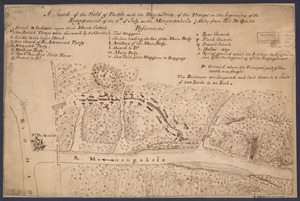
A sketch of the field of battle with the disposition of the troops in the beginning of the engagement of the 9th of July on the...
507.
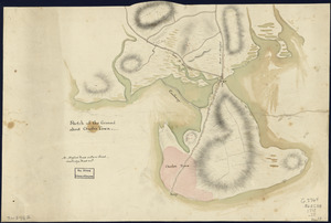
Sketch of the ground about Charles Town
508.
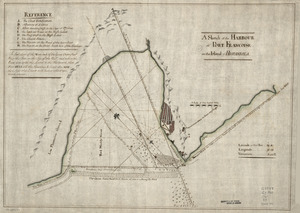
Sketch of the harbour of Charles Town
509.
A Sketch of the harbour of Port Francoise on the Island of Hispaniola
510.
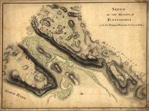
Sketch of the Heights of Kingsbridge 1777, with the proposed redoubts coloured orange : Old rebel works coloured black
511.
Sketch of the Heights of Kingsbridge, with the proposed redouts couloured yellow
512.
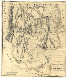
A sketch of the northern parts of New Jersey
513.
Sketch of the rebel works at West Point : as taken from the description of them given by a deserter who came to Stoney Point,...
514.
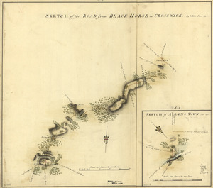
Sketch of the road from Black Horse to Crosswick
515.
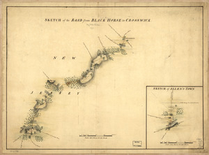
Sketch of the road from Black Horse to Crosswick. Sketch of Allen's Town
516.
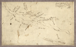
Sketch of the road from Fredericksburg to Norfolk in Virginia
517.
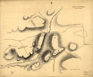
Sketch of the White Plains
518.
Sketch of West Point
519.
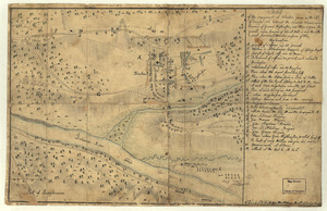
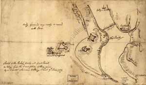
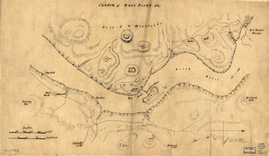
Sketth [sic] of the Hessian attack on Fort Washington under General Knypehausen on the 16th November 1776
520.
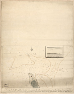
Soundings of the bar of Sandy Hook at low water & the marks made use of for the best water
‹ Prev
Next ›
1
2
…
22
23
24
25
26
27
28


![Sketth [sic] of the Hessian attack on Fort Washington under General Knypehausen on the 16th November 1776](https://bpldcassets.blob.core.windows.net/derivatives/images/commonwealth:q524n878n/image_thumbnail_300.jpg)