Toggle navigation
LMEC Home
Exhibitions
Georeferencing
Tools for Teachers
Collections
My Favorites
Sign Up / Log In
Search
Search the map portal
Map Collection
Map Collection
Map Sets
Search
Search
Search for
Search In
All Fields
Creator
Title
Subject
Place
Search All Digital Collections
Advanced Search
8647 Results
My Search
Start Over
More Like
commonwealth:q524n482d
Remove constraint More Like: commonwealth:q524n482d
Filter your Search
Place
North and Central America
5,886
United States
4,805
Massachusetts
2,068
Europe
1,392
Suffolk (county)
1,041
Boston
1,014
Canada
449
Asia
437
more
Place
»
Topic
Boston (Mass.)--Maps
582
United States--Maps
279
Real property--Massachusetts--Boston--Maps
175
Massachusetts--Maps
161
Landowners--Massachusetts--Boston--Maps
133
North America--Maps--Early works to 1800
103
New England--Maps
101
Europe--Maps
79
more
Topic
»
Date
Date range begin
–
Date range end
Current results range from
1482
to
2023
View distribution
Creator
United States. Hydrographic Office
595
O.H. Bailey & Co
148
Des Barres, Joseph F. W. (Joseph Frederick Wallet), 1722-1824
123
United States. Post Office Dept
120
Ptolemy, 2nd cent
100
Walling, Henry Francis, 1825-1888
94
Geological Survey (U.S.)
86
Jefferys, Thomas, -1771
84
more
Creator
»
Format
Maps/Atlases
8,587
Manuscripts
215
Prints
56
Books
36
Objects/Artifacts
10
Drawings/Illustrations
8
Posters
5
Georeferenced
Yes
869
No
7,778
Collection
Norman B. Leventhal Map & Education Center Collection
8,646
Boston and New England Maps
2,221
Urban Maps
1,992
Maritime Charts and Atlases
1,083
American Revolutionary War-Era Maps
615
Boston Redevelopment Authority Collection
87
Richard H. Brown Revolutionary War Map Collection at Mount Vernon
1
Available to use
No known restrictions
8,504
Creative Commons license
48
Search Constraints
Sort by relevance
relevance
title
date (asc)
date (desc)
Number of results to display per page
20 per page
10
per page
20
per page
50
per page
100
per page
View results as:
grid view
map view
Search Results
1.
A map of the country on the Ohio and Muskingum Rivers : shewing the situation of the Indian towns with respect to the army...
2.
Les provinces des Pays-Bas Catholiques ou A most exact map of Flanders or ye Austrian Netherlands &c : it comprehends all the...
3.
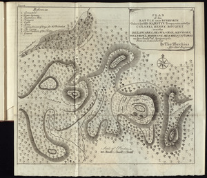
Plan of the battle near Bushy-Run gained by His Majesty's troops commanded by Colonel Henry Bouquet over the Delawares,...
4.
The 100th anniversary map of Abraham Lincoln's visit to Massachusetts, September 11-23, 1848
5.
1630 shoreline
6.
1879. Progress map of the U.S. Geographical Surveys west of the 100th Meridian : prepared under the direction of 1st Lieut....
7.
1903 Map of Salem and surrounding places
8.
19th annual convention of the National Association of Real Estate Boards : at Tulsa, June 7 to June 11 in 1926
9.
2005 significant U.S. hurricane strikes
10.
The 2100 project : an atlas for the Green New Deal
11.
227 Harzgerode
12.
305 Glatz
13.
38,000,000 escaped -- 10,000,000 died
14.
4 Kinten
15.
660 Wakulah St., Roxbury
16.
74 miles on the ocean scenic highway U.S. 1
17.
[A chart of Boston Bay and vicinity]
18.
[A chart of New York Island & North River : East River, passage through Hell Gate, Flushing Bay, Hampstead Bay, Oyster,...
19.
The A.A.A. key road map of continental Europe
20.
Aaron Bohrod's America, its history
‹ Prev
Next ›
1
2
3
4
5
…
432
433


![[A chart of Boston Bay and vicinity]](https://bpldcassets.blob.core.windows.net/derivatives/images/commonwealth:cj82m2976/image_thumbnail_300.jpg)


