Toggle navigation
LMEC Home
Exhibitions
Georeferencing
Tools for Teachers
Collections
My Favorites
Sign Up / Log In
Search
Search the map portal
Map Collection
Map Collection
Map Sets
Search
Search
Search for
Search In
All Fields
Creator
Title
Subject
Place
Search All Digital Collections
Advanced Search
8704 Results
My Search
Start Over
More Like
commonwealth:q524n3673
Remove constraint More Like: commonwealth:q524n3673
Filter your Search
Place
North and Central America
5,927
United States
4,845
Massachusetts
2,079
Europe
1,396
Suffolk (county)
1,047
Boston
1,020
Canada
449
Asia
438
more
Place
»
Topic
Boston (Mass.)--Maps
587
United States--Maps
282
Real property--Massachusetts--Boston--Maps
175
Massachusetts--Maps
162
Landowners--Massachusetts--Boston--Maps
133
North America--Maps--Early works to 1800
103
New England--Maps
102
World maps
82
more
Topic
»
Date
Date range begin
–
Date range end
Current results range from
1482
to
2023
View distribution
Creator
United States. Hydrographic Office
595
O.H. Bailey & Co
148
Des Barres, Joseph F. W. (Joseph Frederick Wallet), 1722-1824
123
United States. Post Office Dept
120
Ptolemy, 2nd cent
100
Walling, Henry Francis, 1825-1888
94
Geological Survey (U.S.)
86
Jefferys, Thomas, -1771
85
more
Creator
»
Format
Maps/Atlases
8,644
Manuscripts
218
Prints
56
Books
36
Objects/Artifacts
10
Drawings/Illustrations
8
Posters
5
Georeferenced
Yes
868
No
7,836
Collection
Norman B. Leventhal Map & Education Center Collection
8,701
Boston and New England Maps
2,235
Urban Maps
2,024
Maritime Charts and Atlases
1,083
American Revolutionary War-Era Maps
616
Boston Redevelopment Authority Collection
88
Sidney R. Knafel Map Collection at Phillips Academy
2
Available to use
No known restrictions
8,555
Creative Commons license
50
Search Constraints
Sort by relevance
relevance
title
date (asc)
date (desc)
Number of results to display per page
20 per page
10
per page
20
per page
50
per page
100
per page
View results as:
grid view
map view
Search Results
4521.
A map of the West-Indies or the islands of America in the North Sea : with ye adjacent countries; explaning [sic] what belongs...
4522.
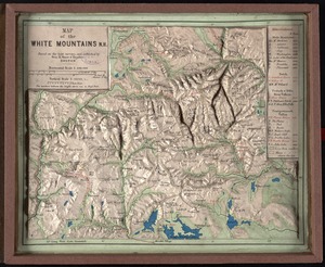
Map of the White Mountains, N.H : based on the best surveys
4523.
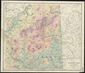
Map of the White Mountains, N.H
4524.
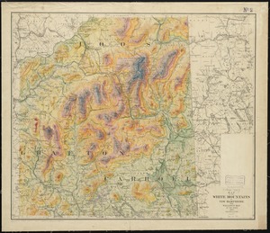
Map of the White Mountains of New Hampshire from Walling's large map of the state, 1881
4525.
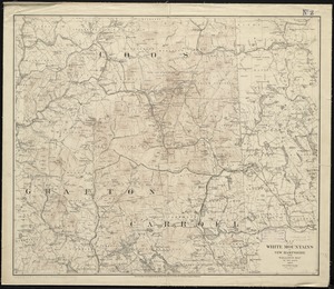
Map of the White Mountains of New Hampshire from Walling's map of the state, 1877
4526.
Map of the White Mountains of New Hampshire from Walling's map of the state 1877
4527.
A map of the wondrous isle of Manhattan
4528.
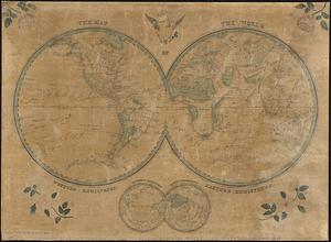
The map of the world
4529.
A map of the world : corrected from the observations communicated to the Royal Societys of London and Paris
4530.
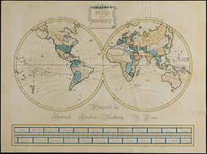
Map of the world
4531.
A map of the world from the best authorities
4532.
A map of the world on a globular projection : exhibiting particularly the nautical researches of Captain James Cook, F.R.S. :...
4533.
A map of the Yearly Meeting of Friends for New England : 1850
4534.
A map of the yearly meeting of Friends for New England A.D. 1833
4535.
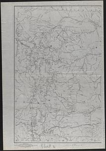
Map of the Yellowstone and Missouri Rivers and their tributaries : explored by Capt. W.F. Raynolds, Topl. Engrs., and 1st...
4536.
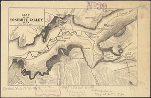
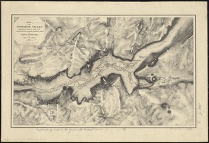
Map of the Yosemite Valley
4537.
Map of the Yosemite Valley : from surveys made by order of the Commissioners to manage the Yosemite Valley and Mariposa Big...
4538.
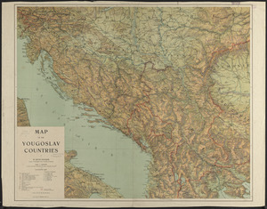
Map of the Yougoslav countries
4539.
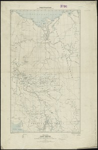
Map of the Yukon Territory to illustrate the summary reports of R.G. McConnell, B.A., Jos. Keele, B.A., and C. Camsell, B.A
4540.
A map of those countries in which the apostles travelled : in propagating Christianity
‹ Prev
Next ›
1
2
…
223
224
225
226
227
228
229
230
231
…
435
436