The map of the world
Item Information
- Title:
- The map of the world
- Description:
-
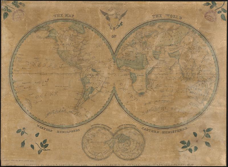
Manuscript map in ink, watercolor and pencil. Drawn by a schoolboy attending the Wesleyan Seminary in Wilbraham, Massachusetts. Double hemisphere map of the eastern and western hemispheres, with a smaller double hemisphere map of the southern and northern hemispheres.
- Cartographer:
- Leonard, Graty P.
- Name on Item:
-
executed by Graty. P. Leonard. at the Wesleyan Seminary
- Date:
-
1833
- Format:
-
Maps/Atlases
- Genre:
-
Manuscript maps
World maps
- Location:
-
Boston Public Library
Norman B. Leventhal Map & Education Center - Collection (local):
-
Norman B. Leventhal Map & Education Center Collection
- Places:
-
World
- Extent:
- 1 manuscript map : hand colored ; 2 hemispheres each 50 cm in diameter, on sheet 60 x 82 cm
- Terms of Use:
-
No known copyright restrictions.
No known restrictions on use.
- Place of origin:
-
Wilbraham, Massachusetts
- Scale:
-
Scale approximately 1:55,000,000 at equator
- Language:
-
English
- Notes:
-
Relief shown by shading.
Prime meridian: [Ferro].
Includes illustrations of the United States coat of arms above the map and flowers in the corners.
- Identifier:
-
06_01_016970
- Call #:
-
G3200 1833 .L46
- Barcode:
-
39999085953048


