Toggle navigation
LMEC Home
Exhibitions
Georeferencing
Tools for Teachers
Collections
My Favorites
Sign Up / Log In
Search
Search the map portal
Map Collection
Map Collection
Map Sets
Search
Search
Search for
Search In
All Fields
Creator
Title
Subject
Place
Search All Digital Collections
Advanced Search
234 Results
My Search
Start Over
More Like
commonwealth:p8418t713
Remove constraint More Like: commonwealth:p8418t713
Filter your Search
Place
United States
227
North and Central America
216
New England
91
Boston
78
Suffolk (county)
78
Boston Harbor
40
Canada
24
Middle Atlantic
21
more
Place
»
Topic
New England--Maps--Early works to 1800
91
Boston (Mass.)--Maps--Early works to 1800
46
Boston Harbor (Mass.)--Maps--Early works to 1800
38
United States--History--Revolution, 1775-1783--Maps--Early works to 1800
36
Boston (Mass.)--History--Revolution, 1775-1783--Maps--Early works to 1800
29
Middle Atlantic States--Maps--Early works to 1800
20
Bunker Hill, Battle of, Boston, Mass., 1775--Maps--Early works to 1800
18
Fortification--Massachusetts--Boston--Maps--Early works to 1800
14
more
Topic
»
Date
Date range begin
–
Date range end
Current results range from
1617
to
1999
View distribution
Creator
Page, Thomas Hyde, Sir, 1746-1821
12
Faden, William, 1749-1836
11
Jefferys, Thomas, d. 1771
9
Bellin, Jacques Nicolas, 1703-1772
7
Robert Sayer and John Bennett (Firm)
7
Lattré, Jean
6
Jefferys, Thomas, -1771
5
Le Rouge, Georges-Louis
5
more
Creator
»
Format
Maps/Atlases
232
Manuscripts
20
Drawings/Illustrations
2
Georeferenced
Yes
18
No
216
Collection
American Revolutionary War-Era Maps
173
Norman B. Leventhal Map Center Collection
136
Boston and New England Maps
89
Mapping Boston Collection
46
Richard H. Brown Revolutionary War Map Collection at Mount Vernon
29
Urban Maps
26
New-York Historical Society Collection
24
Maritime Charts and Atlases
22
more
Collection
»
Available to use
No known restrictions
115
Creative Commons license
101
Search Constraints
Sort by relevance
relevance
title
date (asc)
date (desc)
Number of results to display per page
20 per page
10
per page
20
per page
50
per page
100
per page
View results as:
grid view
map view
Search Results
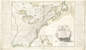
61.
Boston, with its environs
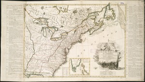
62.
Carta rappresentante il porto di Boston
63.
Carte du port et havre de Boston avec les côtes adjacentes, dans laquel on a tracée les camps et les retranchemens occupé,...
64.
Carte du port et havre de Boston avec les côtes adjacentes, dans laquel on a tracée les camps et les retranchemens occupé,...
65.
Carte du port et havre de Boston avec les côtes adjacentes, dans laquel on a tracée les camps et les retranchemens occupé,...
66.
Carte particuliere du havre de Boston : avec les sondes les bancs de Sable, les rochers les Amaies et les autres directions...
67.
Carte particuliere du havre de Boston : avec les sondes les bancs de Sable, les rochers les Amaies et les autres directions...
68.
A chart of the harbour of Boston
69.
A chart of the Harbour of Boston, with the soundings, sailing-marks, and other directions
70.
A chart of the Harbour of Boston, with the soundings, sailing-marks, and other directions
71.
A large draught of New England, New York and Long Island
72.
A new and accurate chart of the harbour of Boston in New England in North America
73.
A new suruey of the harbour of Boston in New England
74.
Plan de Boston avec les sondes et les directions pour la navigation : traduit de l'anglais
75.
A plan of the town and harbour of Boston : and the country adjacent with the road from Boston to Concord, shewing the place of...
76.
Carte de l'Amérique Septle. pour servir à l'intelligence de la guerre entre les Anglois et les insurgents
77.
Carte des Etats-Unis d'Amérique, et du cours du Mississippi : rédigée d'après différentes cartes et relations Anglaises et...
78.
Carte des Etats-Unis de l'Amerique suivant le Traité de Paix de 1783
79.
Carte des Etats-Unis de l'Amerique suivant le Traité de Paix de 1783
80.
Carte du théatre de la guerre entre les Anglais et les Américains
‹ Prev
Next ›
1
2
3
4
5
6
7
8
…
11
12